The previous blog covers a tour around the island of Senja with its stunning wild and rugged west, more populated east and forested south.
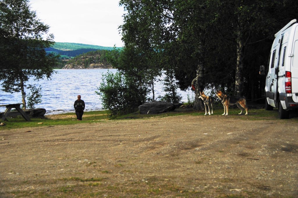
Day 53: 28 August 2020 – late afternoon we left the Island of Senja and made our way on the Fv855 to the European Route E6which is the main transport route north-south in Norway (and in many places the only route north-south in Norway). The E6 is generally kept open even in winter, typically only closing about 10 days a year. It also involves a ferry crossing in one place which will be detailed within this blog. Speed limits on this route vary from 30km/hour within built up areas up to 90km/hour; however, the most common speed is 80km/hour which is enforced by speed cameras.
Parking places that we deem suitable are few and far between on the E6; however, we did find an off-road parking place alongside the river Salangsdalselva, which masked off all traffic noise from the E6.
Salangsdalselva River, Norland Couty, Norway
European Route E6 and the Salangsdalselva River, Norland Couty, Norway
The map below shows the route taken on day 53 since leaving Senja and illustrates where the photographs have been taken:
Day 53 Route since leaving Senja
Day 54: 29 August 2020 – The first stop for the day was at a rest area in front of the Gratangsfjellet hotel which we assume was closed due to the Covid19 pandemic. At the side of the hotel are toilets (WC) available for users of the rest area. We had stopped here on the northwards journey covered in part 5 of this blog series. From the service area we walked circa 2km up the no longer used old E6 road, to where it re-joined E6 at the top of the hill. In places this presented a good view of the Gratagen fjord below and looked very different to the photographs taken on the 16 August.
Gratangsfjellet Hotel, Norland County, Norway
Gratagen Fjord, Norland County, Norway
Ten kilometres south of the Gratangsfjellet hotel, is the county border between Troms og Finnmark and Norland.
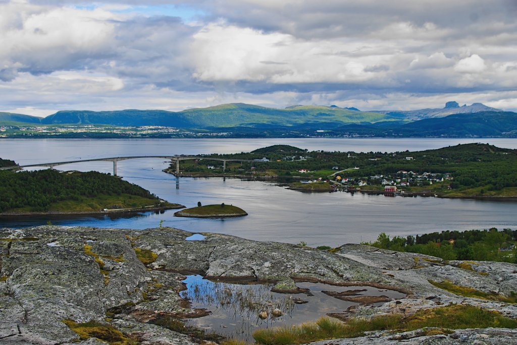
The E6 descends from an altitude of circa 300m down to Rombaken fjordwhere it is crossed via the 1.5km long Halogaland bridge which was constructed in 2018 and is the second longest bridge span in Norway with a toll charge of 90kr. The picture below was taken from the south side of Rombaken fjord, looking northwards.
Halogaland Bridge on road E6, north of Narvik, Norland County, Norway
Throughout Norway there are either plastic or metal markers to be found in the middle of no-where. The photograph below was taken and run through ‘Google Assistant‘, which advised it to be a land boundary marker.
Norwegian Boundary Post for Land Boundary Demarcation at the Halogaland bridge
The Halogaland bridge almost immediately leads into Narvik. Narvik was formerly a farmstead on the Ofotfjorden, but in the late 1800’s iron ore from the mines in the mountains of Northern Sweden needed to be transported to the coast and the ice-free Northern Norwegian coast was the only practical solution, since the Bothnian Bay (Bottenvika) on the Swedish coast of the Baltic is ice-bound for half the year. In 1902 Narvik was given town status at the same time that the Ofoten Railway Line to the Swedish border was completed. Narvik was also of strategic military importance during World War II and is known for the battles of Narvik.
The E6 runs through Narvik and at the south western point of the town crosses Beisfjordenuses the 375m long Beisfjord Bridge.
Narvik and Beisfjorden from Ankenes (south side of the fjord) , Norland County, Norway
We did not discover an overnight parking place until reaching Storoya, a small island in the middle of Efjorden. As the crow flies this is some 40km from Narvik. The parking was busy with other motorhomes, which was a reflection to the amount of suitable parking on the E6.
Storoya and Efjorden, Norland County, Norway
The map below shows the route taken on day 54 and illustrates where the photographs have been taken:
Day 54 Route
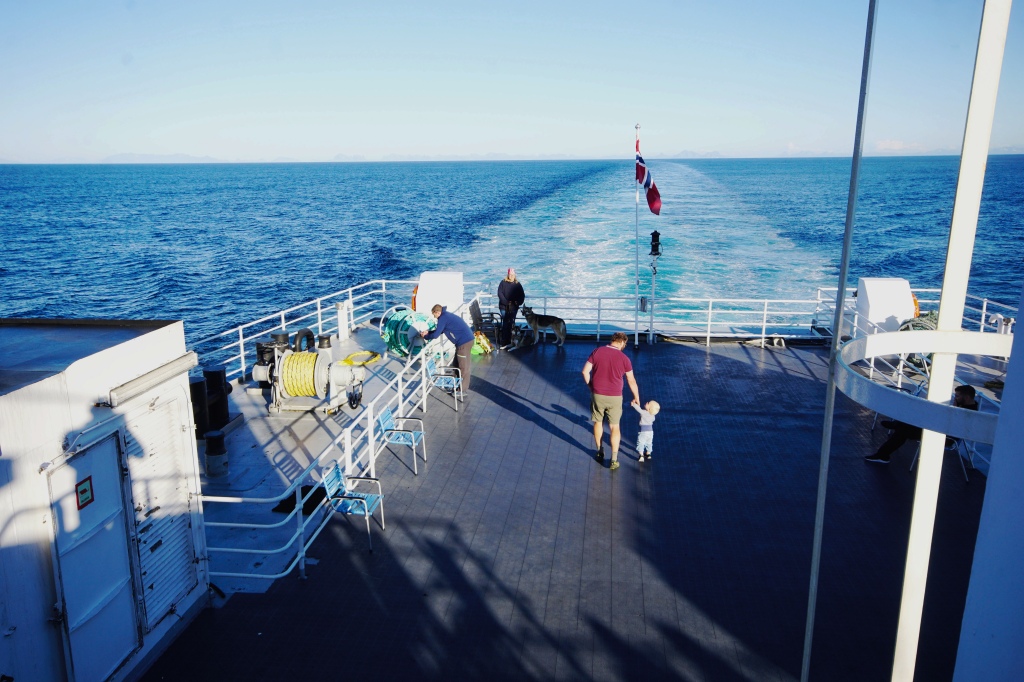
Day 55: 30 August 2020 – Continued from Storoya southwards on the E6. After about 15km reached the ferry port of Skarberget, where to continue on the E6 you need to pick up a ferry to Bognes, which takes circa 25 minutes for the 6.5km journey.
Ferry between Skarberget and Bognes, Norland County, NorwayFerry between Skarberget and Bognes, Norland County, Norway
From Bognes travelled just under 20km further south on the E6 to Ulvsvag, where we turned off on county road Fv81, which runs alongside the very attractive Presteidfjorden.
County Road Fv7530 is 14.3km long and ends at the village of Tranoy. About 5km before the village we discovered excellent off-road parking with fantastic views acrossVestfjorden towards the Lofoten Peninsula.
Off-road parking just off Tranoyvein, Hamaroy, Norland County, Norway
Tranoyvein, Hamaroy, Norland County, Norway
View across Vestfjorden to the Lofoten Archipelago from Tranoyvein, Hamaroy, Norland County, Norway
White tailed eagle, Tranoyvein, Hamaroy, Norland County
Rough Legged Hawk, Tranoyvein, Hamaroy, Norland County, Norway Tree Pipit, Tranoyvein, Hamaroy, Norland County
There was also a beautiful walk through the forest around a maze of cross-country ski tracks.
Forest cross country ski track walk
The weather had been very good for most of the day, with just a shower in the late evening after which there was a gorgeous sunset over the Lofoten Archipelago.
Sunset over the Lofoten Archipelago from Tranoyvein, Hamaroy, Norland County, Norway
The nights have started to draw in quickly and once the sunlight goes the temperature drops very quickly. Earlier on the trip nights were illuminated 24 hours: however, it is now dark just after 9pm. Last night was the first dark starry night we have encountered, with the north star shining exceedingly bright.
This detour on a spur away from the main European Route E6 was exceptionally beautiful and well worth taking.
The map below shows the route taken on day 55 and illustrates where the photographs have been taken:
Day 55 Route
Day 56: 31 August 2020 –The day was predominantly dry but cloudy with a strong wind coming off the sea, which started to blow the leaves from the trees – a sign that autumn was on its way (i.e. the fall, for North American readers).
We redid the same forest walk that we did yesterday. The size of the ant-hills are really impressive.
Size of typical Ant Hill
Forest cross country ski track walk with Ant Hill to the right
After yesterday’s abundance of raptors, today we did not see one.
We did not depart our parking place until 15:30 hours and explored the very pretty village of Tranoy, which is at the end of the peninsula. After which we headed back and re-joined the E6 heading south. In total we only travelled 1.5 hours total before we parked up in a parking area adjacent to the E6 the opposite side of a road to Hillingspollen fjord.
Day 56 Overnight Parking
The map below shows the route taken on day 55:
Day 56 Route
Day 57: 1 September 2020 – During a morning walk along Hillingspollen fjord shoreline we heard a tremendous noise similar to a wind turbine. This was in fact the noise from the flapping of wings as a white-tailed eagle took off no more than 30 meters away. The eagle flew directly over a couple of Whooper Swans, making the swans look miniature in comparison to the eagle.
Whooper Swans, Innhavet, Norland County, Norway
The first stop for the day was at Innhavet where there is a motorhome service point where drinking water can be replenished and waste water / chemical toilet emptied. There was also a supermarket for groceries.
Continued southwards on the E6 for another 20km until we came upon a Krakmotinden which is a mountain of 924m altitude and is in effect a solid piece of rock.
Krakmotinden (924m), Norland County, Norway
Morsvikfjorden is circa 15km further south, where ther is the village of Morsvikbotn which is some 30km from Innhavet. During World War II there was a prisoner of war camp at Morsvikbotn. Here the mountains were very different since they appeared to be formed from a solid piece of rock.
Morsvikbotn, Norland County, Norway
We turned off the E6 at Sildhopen onto county road Fv7500 which is 25.4km long and loops around re-joining the E6 a little further south. Indeed Fv7500 was formerly part of the old E6 until both the Kobbskarand Middagsfjellet tunnels were built.
County Road Fv7500, Norland County, Norway
Not far down the Fv7500 we parked and took the dogs on a signed walk through the forest. At the start of this walk was a community area that included a shelter, barbecue and cooking area including firewood, pots and pans and a small children’s play area.
Community Area near Sildhopen, Norland County, Norway
The forest walk was probably the most enjoyable forest walk we have ever done, where there was no physical sign of a path and the route was indicated by the occasional trees marked with paint.
Forest walk near Sildhopen, Norland County, Norway
The footpath eventually re-joined the road further along, so we returned via road to the motorhome.
We drove a little further south on the Fv2500 where we pulled up at 16:00 hours to enjoy the late afternoon sun. We decided it was so nice we would shower outside – this was indeed a shower with a view!
Shower with a view, South of Sildhopen, Norland County, Norway
South of Sildhopen, Norland County, Norway
South of Sildhopen, Norland County, Norway
South of Sildhopen, Norland County, Norway
The map below shows the route taken on day 57, which was as the crow flies only 39km from the previous days overnight parking place. The map also illustrates where the photographs have been taken:
Day 57 Route
Day 58: 2 September 2020 – Prior to setting off the dogs were taken a walk in the forest. The image below shows Freya inspecting the Fungi, but gives an indication to its size.
Freya inspecting Fungi
Leirfjorden is a beautiful fjord, circa 17km southwards down county road Fv7500 and is worth visiting for the views. After reaching Leirfjorden it is around 5km before the Fv7500 re-joins the E6.
Road 7500, Leirfjordgard, Leirfjord, Sørfolda fjord, Norland County
Engan, Leirfjord, Norland County, Norway
By the E6 just above the southern shore of Leirfjorden is Kjelvik farm which is an old Sami farmstead museum. Unfortunately, this which was closed due to Covid19 pandemic; however, we were welcome to wander around. The farm has its roots back to 1747; however, the last tenant died in 1967 and this is how it has remained. There is no running water or gas and in 1967 all goods needed to come in via the sea, so would be carried 2km up 300m ascent. It was not until 1986 that the E6 was built.
Kjelvik Farm, Norland County, Norway Drying HayDrying HayBlacksmith
The floor for some of the buildings was constructed of stone flags raised on a wooden frame, thus keeping the buildings floor above the outside ground level; however, there some quite large holes in the floor. One can only imagine the draught coming through the gaps in the floor during the arctic winter.
Composting Toilet, Kjelvik Farm, Norland County, Norway
That evening we stopped at a service area on the southern edge of the village of Rognan, which in 2018 had a population of 2584 people. In the evening we walked alongside the river Saltelva into Rognan. The river has fame for the quantity of salmon.
The map below shows the route taken on day 58 and illustrates where the photographs have been taken:
Day 59 Route
Day 59: 3 September 2020 – The morning was spent touring the blood road aroundRognan. The Saltdal Bygdetun Museum (folk museum) is built around a farmstead dating 1750 until the end of the nineteenth century and shares the same grounds as the Blood Road Museum, which provides the story of the lives and work of prisoners of war under the German regime from 1942-1945 is presented in a German barracks moved here from Dunderdalen. Thousands of prisoners of war from eastern Europe were sent north to build roads and railways. They suffered inhuman conditions. Many never returned. Unfortunately, both museums were closed to visitors due to the Covid-19 pandemic, but we were free to walk around the grounds and admire the buildings.
Saltdal Bygdetun (closed due to Covid19) Norland County, Norway
One of the worst concentration camps was at Botn. In May 1945 there were circa 9500 POWs in Saltdal divided between 17-18 camps. Of these 7700 were Russian, 1000 Poles & 800 Yugoslavians. Blood road stretches around the fjord bay and it has been estimated that about 13700 Russian and 2370 Yugoslavians died in Norway. Follow these links for further reading on Norway under German occupation especially blood roads and Soviet prisoners of war.
From the museums it is a short journey along the coastal ‘blodvegen’ road eastwards to the E6. Just prior to the E6 there is a memorial to the many Prisoners of War (POW’s) from the Soviet Union, Poland and Yugoslavia that were forced to labour in building the roads and railways in northern Norway. Some 34,000 forced labourers were kept in 54 POW camps.
Yugoslav Memorial, Saltdal, Rognan, Nordland County, Norway
A further kilometre further along, there is the village of Botn, where circa 500m up the hill there are 4 second world war places of interest. These are a German war cemetery containing 2742 burials, a Yugoslav war cemetery containing the remains of 1657 POW’s, a memorial for the 111 Soviet POW’s buried in a mass grave and a white cross indicating the site used for the execution of prisoners of war, most of them being Yugoslav.
Location of Memorials, Cemeteries and Museum
German War Cemetery Botn-Rognan, Norland County, NorwayGerman War Cemetery Botn-Rognan, Norland CountyGerman War Cemetery Botn-Rognan, Norland County, NorwayYugoslav War Cemetery Botn-Rognan, Norland County, NorwayYugoslav War Cemetery Botn-Rognan, Norland County, Norway
From Botn we headed south ascending the Saltfjellet mountain pass (altitude 693m) The following photographs were taken circa three-quarters the way up:
Road E6, Saltfjellet mountain pass, Norland County
The top of Saltfjellet is extremely flat and after travelling 12km from the summit point we reached the Arctic Circle Centre which opened in 1990. Apart from a shop and café, there is also small exhibition plus an array of taxidermy Arctic animals, including polar bear, fox, seal, reindeer, elk, eagle, wolf, wolverine, lynx, otter, brown bear, fox and hare.
E6 Sumit of Saltfjellet mountain pass (693m), Norland County
Arctic Circle Centre on E6 (660m altitude), Norland County, Norway
There were several parking places on top of Saltfjellet; however, we decided not to stay overnight here even though it was glorious and sunny, since the wind had strengthened significantly and as a result it was extremely cold. Hence we continued on, dropping from the summit which resulted in a significant rise in temperature.
As we have found previously in Norway it can take considerable time to find parking places suitable for an overnight stay and unfortunately this was the case on day 59 of our trip. It took circa 3 hours of continuous driving before we found a parking place for the evening that we deemed suitable. This was on county road Fv806.
We had decided for our journey south to try where possible, to avoid the main north-south E6 route and use alternative quieter more minor routes through the centre and eastern side of Norway. Hence why we picked up the Fv806, which was a more windy and narrower alternative to the E6. We parked at the carpark for walkers wanting to visit the potholes of Jettegrytene.
The map below shows the route taken on day 59 and illustrates where the photographs have been taken:
We left the Arctic Circle with heavy hearts after spending 33 days within it. It was a place we had always wanted to vist and found that it grossly exceeded our expectations. We will certainly try and visit again!
The next blog will detail the trip southwards taking Duncan and Liz out of Norway and will include the incredible UNESECO world heritage mining town of Roros and the Rondane National Park.
The previous blog covers the journey along the northern border of Finland to Karosjohka where the Sami people have their parliament and then onto the island of Kvaloyawhere there is Hammerfest, the world’s most northern city. From Kvaloya, the blog continues with the journey southwards to Finnsnes which is the gateway to the Gisund Bridge which leads to the island of Senja.
The Gisund Bridge taken from the mainland, with the island of Senja at the other side of the Sound.
Senjais Norway’s second largest island outside of the Svalbard archipelago with a landscape that varies greatly from east to west, hence the island is often called a ‘Norway in miniature’. In summary it has a rugged stunning mountainous western coast that faces the Atlantic Ocean. The western and northern coastline contains numerous narrow fjords and sheltered bays that contain colourful fishing villages, with 700-800m high rocky-mountains with sharp ridges rising from the ocean. The central part of Senja is mountainous with forest at lower levels; whilst the mainland facing eastern coast has lush green meadows and valleys interlaced with small lakes.
Norway in its entirety is wondrously beautiful, but for Duncan and Liz there were two places that especially stood out. Senja being one, whilst the other was the Nordkinn peninsula detailed in part 5 of this blog series.
Day 48: 23 August 2020 – The morning journey from Lyngen Fjord to Finnsnes was covered under the previous blog.
Crossing the Gisund Bridge, we arrived at the village Silsand on the island of Senja, which is now considered a suburb of Finnsnes.
Turned right onto the Fv861 almost immediately after crossing onto the island, since we had decided to take an anticlockwise direction trip around Senja. This road heads northwards tracking the eastern coast of Senja. This eastern coastline has numerous small villages segregated with a mix of forest and agricultural land; with detached properties dotted near the road in a manner that it is rare that you unable to see a dwelling.
Parked up for the day at a car parking place just before the junction between Mefjordbotn (Fv862) and Fjordgard (Fv7884). Clouds were starting to form so Duncan decided to make the best of the dry weather and take to the mountains with Freya in order to take some photographs, whilst Liz did a much lower level walk with Storm.
Duncan and Freya headed up Barden. This involves a climb up a saddle (circa 240m altitude) between Barden(659m) to the north-west and Grytetippen (885m) to the north-east. The footpath up is marked but in places extremely wet with water up to the ankles. The views from this col were breath-taking.
Øyfjorden – Ascent of Barden (659m) from Ornfjordtunnelen entrance, Isle of Senja, Finnmark County
Freya (Northern Inuit), Grytetippen (885m) and Keipen (936m), Isle of Senja, Troms og Finnmark, Norway
Barden (659m) in cloud, Isle of Senja, Finnmark County
Barden (659m) in the distance on the Island of Senja, Troms og Finnmark, Norway
Freya (Northern Inuit) on Barden (659m) overlooking Mefjorden, Isle of Senja, Troms og Finnmark, Norway
From Barden (659m) with Merfjorden (left) and Øyfjorden (right), Isle of Senja, Finnmark County
Footpath in red to Barden and Grytetippen from entrance to Ornfjord tunnel
Ascent of Barden (659m) from Ornfjordtunnelen entrance, Isle of Senja, Finnmark County
View south of Barden (659m), Isle of Senja, Troms og Finnmark, Norway
Barden (659m) with Mefjorden (left) and Øyfjorden (right), Isle of Senja, Troms og Finnmark, Norway
Descending Barden the view of the col with the Ornfjordtunnelen exit below, Isle of Senja, Troms og Finnmark, Norway
Øyfjorden when ascending Barden (659m), Isle of Senja, Finnmark County
The walk up Barden not only provided excellent views but the increasing cloud added a dimension to the photographs. The cloud thickened so on the descent visibility reduced to circa 30m and heavy rain started before Duncan and Freya could return to the motorhome.
The map below shows the route taken on day 48 and illustrates where the photographs have been taken:
Day 48 Route on Senja
Day 49: 24 August 2020 – Today was a day of a lot less travel, where we explored Oyfjorden i.e. the eastward (right) fjord seen in yesterday’s photographs taken from Barden. Unfortunately, it was damp with low cloud otherwise it would have presented a fantastic photographic opportunity.
Oyfjorden from Fjordgard at Keipan (660m), Finnmark County
Oyfjord has two fishing villages, Fjordgard and Husoy. Previously there were three other small settlements on the west coast of Oyfjord, but these have been abandoned. These were Tofta, Øyfjordvær and Breivika.
Fjordgård lies beneath steep mountains and lies on the west shore of the fjord Ornfjorden, which is an arm that branches off of the main Øyfjorden. Fjordgard is accessible by road using county road Fv7884 which is 4.2km long and has 3 tunnels on it: Fjordgard pipe tunnel (171m), Fjordgard tunnel (2284m), and the Ornfjord tunnel (870m). In 2001 the village had a published population of 213 people. There is parking and toilets just to the north of the village where the road terminates.
Fjordgardtunnelen, to Fjordgard, Island of Senja, Finnmark County, Norway
Oyfjorden and Fjordgard village, Finnmark County
Fjordgard village, Isle of Senja, Troms og Finnmark, Norway
Husoy is at the east side of Oyfjorden and is concentrated on a small island (with the same name) connected to Senja by a 250m long causeway. Husoy became a settlement in the 1950’s and in 2017 had a population of 285 people and has since started to overspill onto the mainland of Senja.
Husoy, in Oyfjorden taken from across the fjord at Fjordgard, Isle of Senja, Troms og Finnmark, Norway
Husoy is accessible via the 11.7km long Fv7886 and has two tunnels on it: Riven tunnel (935m) and Fjellsenden tunnel (765m). From the county road Fv862 the road rises from sea level to 200m in altitude when it enters Fjellsenden tunnel, after which it rises to 280m before entering the Riven tunnel after which it descends down to Husoy over a distance of a couple of kilometers. This provides a great view looking down onto Husoy.
Village of Husoy on Island of Husoy, in Oyfjorden, Finnmark County
HusoyHusoyThe causeway onto HusoyOverspill of Husoy onto Senja mainlandToften (abandoned) across OyfjordStockfish curing under roof eavesGreat Cormorant (Phalacrocorax Carbo)
The map below shows the route taken on day 49 and illustrates where the photographs have been taken:
Day 49 Route
Day 50: 25 August 2020 – The day was dry but unfortunately there was a low cloud hiding the mountain tops.
Travelled the southern side of Mefjorden on Fv7868 to the end of the road at Mefjordvaer, which is a fishing village that had 171 inhabitants in 2017. The village is offered protection from the Atlantic weather by the small mountain Knuten (110m altitude) which is to the northwest under which there is a sheltered harbour.
The total length of Fv7868 is only 5.8km and passes Senjahopen, which is a fishing village with a good natural harbour and had 305 inhabitants in 2017. The majority of the working population work in fishing, fish farming or fish processing and it is one of the most important fishing villages on Senja. There is also a motorhome service point where drinking water can be replenished / waste water and toilet emptied.
We pulled up for a long break between Mefjordvaer and Senjahopen in a hope that the cloud may lift thus providing an opportunity for reasonable photographs, but unfortunately the cloud remained. Whilst waiting we encountered otters and a reasonably small sized raptor which initially, we thought was female Eurasian Kestrel; however, the Merlin Bird Identification Appsuggested it to be an Immature Female Merlin (Falco Columbarius).
Low cloud hiding the mountains on the northeast side of Mefjorden, Isle of Senja, Troms og Finnmark, Norway
Knowing from yesterday’s walk-up Barden that the scenery was stunning and the inability to fully see it due to the low cloud was somewhat frustrating for Duncan and Liz as they back tracked down Mefjorden until they picked up the Fv862 which in a southerly direction almost immediately enters the 2.1km long 6m wide Geitskar tunnel(aka Goat Tunnel). The tunnel takes you through to a small valley circa 1.5km long before reaching the head of Ersfjorden where there is a beautiful beach, free camping facility with picnic tables and campfire sites and a toilet (WC) with outside cold-water shower facility. The village of Ersfjord is a settlement in the innermost part of Ersfjorden and in 2015 had a population of 40 people.
About 2.5 km further along the Fv862 (in an anticlockwise direction) is the Tungeneset viewpoint, which is at the tip of a peninsula between Ersfjorden and Steinfjorden. Here there is parking with a modern toilet (WC), along with a wooden walkway down onto the gently sloping rocks that offer a fantastic view of not only both fjords but also the Atlantic Ocean along with theOkshornan is a mountain range which towers over Ersfjorden.
Ersfjorden, Isle of Senja, Finnmark County
Steinfjorden, Isle of Senja, Troms og Finnmark, Norway
At the head of Steinsfjorden is Steinfjord, which is a fishing village with a population of 25 people in 2015. From Steinfjord we passed through the 1.3km long Steinfjord tunnel which took us to Bergsfjorden which has the settlement of Skaland on its northern shore. In 2017 Skaland had 198 inhabitants with its main industry being graphite mining and processing.
Leaving Bergsfjorden, county road Fv862 climbs sharply with a couple of hairpin bends on the incline. At the second incline there is a viewpoint over Bergsfjorden. It was from this viewpoint that I captured a photograph of a Female Eurasian Kestrel perched on a power cable.
Female Eurasion Kestral, Steinfjorden, Isle of Senja, Finnmark County, Norway
Our next and final destination for the day was a small roadside parking place alongside Straumsbotn fjord. To get here we had to go through the 1.9km long Skaland tunnel which climbed from 180m altitude at the entrance to 300m at the exit after which there was a long descent to the fjord.
It was whilst we were parked that we noticed what looked like a wooden stake sticking up from a small distant islet in the middle of the fjord some 400m away. On viewing this with binoculars we found that it was actually awhite-tailed eagle. The camera mounted with a 150-600mm ultra-telephoto zoom lens was duly set up on a tripod and over a 35-minute period a series of photographs and video taken. According to Gurumaps Pro App the islet was a distance of circa 400m away!
The picture below also has a hooded crow stood just to the right of the eagle. This gives an indication as to the size of this massive raptor!
White Tailed Eagle, Hooded Crow, Common Tern. Straumsbotn Fjord, Isle of Senja, Troms og Finnmark, Norway
White Tailed Eagle, Lavollsfjorden, Isle of Senja, Finnmark County
White Tailed Eagle, Lavollsfjorden, Isle of Senja, Finnmark County, Norway
White Tailed Eagle, Straumsbotn Fjord, Isle of Senja, Troms og Finnmark, Norway
The island in the middle of the fjord is where the White Tailed Eagle was perched, Straumsbotn Fjord, Isle of Senja, Troms og Finnmark, Norway
View towards the mouth of Straumsbotn Fjord, Isle of Senja, Troms og Finnmark, Norway
Black Hooded Crow, Lavollsfjorden, Isle of Senja, Finnmark County, Norway
The map below shows the route taken on day 50 and illustrates where the photographs have been taken:
Day 50 Route
Day 51: 26 August 2020 – Using county road Fv86 we headed west to explore Gryllefjorden and Torskefjorden.
The first stop was at a motorhome service point at Finnsæter, where fresh water could be replenished and both waste water and chemical toilet could be emptied. This service point is next to the Senja Troll Park. Throughout our tour in Norway the facilities for touring motorhomes have been excellent as demonstrated in the photograph below:
Motorhome Service Point at Finnsæter, Isle of Senja, Troms og Finnmark, Norway
A little further on from Finnsæter the photograph below was taken in a north-northeast direction across Bergfjorden towards Skaland. When zooming in on this image it is possible to identify the church at Skaland plus to its right and ascending the mountain can be seen the graphite mines.
Skaland and Bergsfjorden, Senja Island, Isle of Senja, Troms og Finnmark, Norway
We continued on county road Fv86 past the holiday village of Hamnwhich is predominantly constructed on a very small island linked by a bridge.
Hamn and Bergsfjorden, Senja Island, Finnmark County
From Hamn county road Fv86 heads in a southerly direction leaving Bergsfjorden behind and slowly begins to ascend towards Gryllefjorden. Here we parked for lunch just at the entrance of the 850m long Ballesvikskaret tunnel, which was opened in December 2013. Prior to the tunnel being opened the old road climbed up 160m to a col between the mountain peaks of Jesla (548m) and Smatindan (490m). The old road was blocked off to traffic, so we took the opportunity to walk up the road to the Ballesvikskaret col. This disused roadway had suffered numerous rockslides as demonstrated in the photograph below:
During this walk a few photographs were taken including a Eurasian Kestrel in flight.
Eurasian Kestrel, Ballesvikskaret Col, Senja Island, Troms og Finnmark, Norway
Jesla (548m) from the summit of the Ballesvikskaret Col, Senja Island, Troms og Finnmark, Norway
Ballesvika, Isle of Senja, Troms og Finnmark, Norway
At the exit of the Ballesvikskaret tunnel there is a bridge that carries you over Gryllefjorden. If you continue further out of the fjord you arrive at the fishing village of Gryllefjord, that in 2020 had 382 inhabitants, which is a decline from the 1300 people in the 1970’s due to a reduction in fishing. In summer there is a ferry from the village to Andenes on the Island of Andoy in Vesteralen.
Gryllefjorden and Ballesvikskaret tunnel, Senja Island, Finnmark CountyGryllefjord, Senja Island, Finnmark CountyGryllefjorden, Senja Island, Troms og Finnmark, Norway Gryllefjordbotn, Senja Island, Troms og Finnmark, Norway
From Gryllefjorden, we ascended via a number of hairpin bends to another col, before descending down to village of Torsken (population 202 people in 2017) and Torskefjorden, which was the end of the road.
Community Recreation FacilityTorskefjordenTorskefjordenTorskenTorskenTorsken and Torskefjorden, Senja Island, Troms og Finnmark, Norway
We then had to backtrack the way we came and decided to end the day parking at the same place where had started off from in the morning along the shoreline of Straumsbotn fjord.
Whilst walking the dogs along the coastline, we encountered a couple of white-tailed eagles sat on rocks that protruded from the fjord.
White Tailed Eagle, Ytre Breivika, Lavollsfjorden, Isle of Senja, Troms County
White Tailed Eagle, Ytre Breivika, Lavollsfjorden, Isle of Senja, Troms County
The map below shows the route taken on day 51 and illustrates where the photographs have been taken:
Day 51 Route
Day 52: 27 August 2020 – Awoke to rain so was in no rush to set off. Whilst having breakfast we watched a white-tailed eagle fly down the fjord, then perch itself on a rock on the opposite shore. We could never tire of these incredible raptors!
Today we travelled to Grunnfarnes which is on a peninsula south of Torsken and is accessible via the 35km long Fv7862 which has 3 tunnels on it i.e. Kaperskar (598m long), Silfjordura (1.5km long) and Grundfarnestunnelen (595m long).
The Fv7862 gradually climbs from 30m to an altitude of 367m where it enters the Kaperskar Tunnel. The view when exiting the tunnel is a surprise:
Near Sifjord, Island of Senja, Finnmark County
From the Kaperskar tunnel the road gently descends before dropping steeply through 6 hairpin bends before dropping down to Silford. The view of Sifjorden whilst descending was stunning.
Sifjord, Island of Senja, Finnmark County
At the head of Sifjorden, the road splits into two, with the right fork leading to Grunnfarnes and the left fork to Flakstadvåg and Selfjorden – we visited both. The Grunnfarnes tunnel had no lighting, was full of potholes and was leaking water – by far the worst tunnel we have been through; however, work was ongoing to improve it. On exiting this tunnel we were presented with the view of Grunnfarnes and its associated fjord.
Grunnfarnes, Island of Senja, Troms og Finnmark, Norway
Grunnfarnes had a population of 76 people in 2015 and like many Norwegian villages has a communal picnic area with a barbecue, with wood also provided for burning. Also at the end of the road was a very large fish drying area for the stockfish.
Picnic Area with a Barbecue, GrunnfarnesStockfish Racks, Grunnfarnes
On our return journey we stopped at the summit of county road Fv7862 (367m) just after the Kaperskar tunnel so that the dogs could be walked. It was somewhat colder than we had previously encountered and this was compounded when it started to rain. At 630m altitude the rain and wind were biting cold!
Summit of county road Fv7862
Motorhome parked at Kaperskar (367m), Island of Senja, Troms og Finnmark, Norway
The map below shows the route taken on day 52 and illustrates where the photographs have been taken:
Day 52 Route
Day 53: 28 August 2020 – Today we toured some of the southerly parts of the Island of Senja. To access the south, we used county road Fv7856 which is only 6.3km long and is an unsurfaced road.
Fv7856 runs between Svanelvmoen and Øverbotn, Island of Senja, Troms og Finnmark, Norway
Fv7856 picked up the much better surfaced Fv8600 which runs along the southern coast. Here the mountains were less dramatic, it was forested, there were far more dwellings, with the occasional grass field cut into the forest.28
08The south coast off the Fv8600 Island of Senja, Troms og Finnmark, Norway
Since the scenery was less dramatic than we had seen, it was decided to return back to the mainland.
The map below shows the route taken on day 53 and illustrates where the photographs have been taken:
Day 53 Route
Senja has been a truly fantastic experience with a vast contrast between the wild and rugged west to the more populated east and forested south. Indeed, both Duncan and Liz fell in love with the western coast which was extremely quiet, provided fantastic views and had an abundance of raptors.
Senja certainly lives up to title ‘Norway in Miniature’ and for a traveller on a limited timeframe, we would recommend the island since it does give a taste of many other parts of Norway and with a rugged western coast from a photographer’s perspective can certainly match if not exceed the opportunity given in the Lofotens. There were also many walks and unlike much of Norway, there was parking generally available at the start of these walks.
Although dry it was a shame that the visibility was not better from a photographic perspective. It is certainly a place that Duncan and Liz would love to re-visit sometime in the future and spend considerably more time exploring.
The next blog will detail the trip southwards taking Duncan and Liz out of the Arctic Circle. Places visited within this blog include Narvik, Tranoy, Rognan and the blood road.
Further blogs will follow covering the journey back south down through Norway using as many central / easterly roads as possible including the UNESECO world heritage mining town of Roros and the Rondane National Park. After which the journey back to the UK through Sweden, Denmark and Germany.
The previous blog covers the trip from the Lofoten and Vesteralen Archipelago’s up to the Barents Sea to Europe’s most northerly mainland peninsula and the most northerly mainland lighthouse in the world which is at the same latitude as the Northern tip of Alaska.
Day 44: 19 August 2020 – The previous blog covers the morning of day 44 and details the Nordkinn peninsula (part 5 of the trip). From Nordkinn we returned back to Ifjord and headed eastwards on county road Fv98 until we reached the river Tana at Rustefjelbma where the road then headed southwards following the river to Tana Bru. At Tana Bru the Fv98 meets European route E6. Here we picked up the E6 and headed south-westwards following the river Karasjohka, which forms the border with Finland. Just outside the Sami village of Levanjok we parked for an overnight stop.
Near Lebesby, Troms og Finnmark, Norway
Sami people herding Reindeer alongside the Fv98 east of Ifjord, Troms og Finnmark, Norway
Fellesjorda, route 98 east of Ifjord, Troms og Finnmark, Norway
River Karasjohka, border between Finland (lapland on left) and Norway (Troms og Finnmark) on right
River Leavvajohka, near Levanjok, Troms og Finnmark, Norway. The hill in distance is Finland (Laplan)Stream that feeds into the River Leavvajohka, near Levanjok, Troms og Finnmark, Norway.
That evening we walked on the east side of the river Leavvajohka, near Levanjok. During ths walk we came across the skeleton of a reindeer, which enabled us to obtain a pair of reindeer antlers. To transport these antlers, we wrapped them in several plastic bags, which we then taped up. On the return to the UK, Duncan worked in turning them into a wall mounted hat stand. These go well with the red deer antlers Duncan found in Scotland.
Hat stands: Red deer antlers (left) and Reindeer antlers (right)
The map below illustrates the route taken on day 44:
Day 44 Route
Day 45: 20 August 2020 – Travelled south-westwards on the north bank of the river Karasjohka until we reached the village of Karasjohka (also called Karasjok). In total over the last two days, we had travelled circa 130km alongside the northern border of Finland. Within the village of Karasjohka is the Sami People’s Parliament building, which in the Sami language is named the Samediggi or Sametinget .
Sami Parliament Building at village of Karasjohka, Troms og Finnmark, Norway – …behind every picture, there is a story…Sami Parliament Building at village of Karasjohka, Troms og Finnmark, Norway – …behind every picture, there is a story…Sami Parliament (Samediggi or Sametinget) Building at village of Karasjok, Troms og Finnmark, Norway
Karasjok village is located both sides of the river Karasjohka and is 12 kilometres west of the border with Finland. Other than the modern Sami Parliament building there is a tourist information, cultural / contemporary centre (closed due to the Covid-19 pandemic) plus a few shops, garage and airport. In 2017 the population was 1844 people with circa 90% of them being Sami with the majority using Sami as their first language – the area is officially bilingual. Nomadic reindeer herders have lived here for hundreds of years, and the traditional lifestyle is still very much alive.
Snow mobile crossing at at village of Karasjok, Troms og Finnmark, Norway
Tansy (Tanacetum vulgare) growing at Karasjok
During World War II a prisoner of war camp was built in Karasjok by the German’s which was run by the SS. In July 1943 there were 374 prisoners including mostly Yugoslavian POWs plus political prisoners who were made to work widening the road to Finland. After just a few months there were only 111 prisoners still alive. It is recorded that as the prisoners were being moved out of Karasjok , 45 were executed.
From Karasjok we continued in along the E6 in a north-west direction to back to Lakselv. The journey on the E6 from Tanu Bru through to Lakselv is circa 255 km in length and is continuous forest. The photographs below give an indication as to the vastness of this.
Between Porsangmoen and Karasjohka, Troms og Finnmark, Norway – Between Lakselv and Karasjok, Troms og Finnmark, Norway
Finding a suitable place to park overnight proved difficult and it was not until early evening that we came across the first suitable location. This was at the south-westerly most point of the island of Kvaloya which was much further than we had intended; however, the car park we had found included picnic tables and a toilet. Kvaloya is sometimes referred to as ‘whale island’.
South-western point of Island of Kvaloya, Troms og Finnmark, Norway
The map below shows the route taken on day 45 and illustrates where the photographs have been taken:
Day 45 Route
The map below illustrates the key places visited on both day 44 and day 45 and the geographical relationship to both Finland and Russia. It is understandable why in World War II the Germans deemed Norway to be of such strategic importance and why during the Cold War, Norway enforced national service.
Places visited on day 44 and day 45, with the geographical relationship between Norway, Finland and Russia
Day 46: 21 August 2020 – A very early morning walk up the nearby hill named Kargenesfjellet provided nice views off the west coast of Kvaloya.
Kvaloya Island, Troms og Finnmark, Norway
Kvaloya Island, Troms og Finnmark, Norway
Afterwards made our way up the western side of Kvaloya to Hammerfest where we crossed over to the eastern coast of the island to the village of Forsol which is the most northerly village on Kvaloya and is 8km from Hammerfest. Forsol is a fishing village with circa 200 residents and has a fish factory, with reindeer wandering freely in and around the village.
Forsol, Island of Kvaloya, Troms og Finnmark, Norway
Reindeer, Forsol, Island of Kvaloya, Troms og Finnmark, Norway
A short walk from the village centre there is a site where there were Sami grass huts. These have been dated back to 1640. Whilst on the walk we sighted a White Tailed Eagle being harassed by a Parasitic Jaeger
White tailed eagle being harassed by a parasitic jaegerForsol, Island of Kvaloya, Troms og Finnmark, Norway
Sami Settlement dated 1640 inlcuding turf hut, Forsol, Island of Kvaloya, Troms og Finnmark, Norway
From Forsol we returned back to the colourful and vibrant city of Hammerfest, the most northerly city in the world.
Just before dropping down into Hammerfest we reached the airport, which was opened in 1974 and has an 880m long runway that sits above the city at an altitude of 70m across a step on the hillside of Storfjellet (328m).
Hammerfest Airport, Island of Kvaloya, Troms og Finnmark, Norway
The city of Hammerfest with the Airport sited above, Island of Kvaloya, Troms og Finnmark, Norway
We decided due to the Covid-19 pandemic to remain as isolated as possible and hence elected not to wander around Hammerfest, but instead drove slowly around the city.
Reindeer are protected on the island and wander freely around Hammerfest taking little notice of either people or vehicles.
Hammerfest was chartered in 1789, was attacked by the British in 1809, razed by a hurricane in 1856, destroyed by fire in 1890, yet the worst was to occur in February 1945 when the German army retreated from the advancing Russian army, they implemented a scorched earth policy leaving in Hammerfest only the graveyard chapel standing. The article available here, describes the horror of the German retreat in Finnmark where 70,000 people were left homeless. Circa 45,000 people were evacuated from Finnmark by the German’s; however, despite threats of death some 25,000 people throughout Finnmark avoided evacuation by hiding in caves and mountain huts during the winter of 1944–45.
Hammerfest, Island of Kvaloya, Troms og Finnmark, Norway
From Hammerfest, Island of Kvaloya, Troms og Finnmark, Norway
At the south end of Kvaloya we discovered that the Stallogargo tunnel was closed for maintenance, so we were diverted on the old single track road that clings to the cliffs and runs along the coast circa 50m above the Kvalsundet which is a strait separating Kvaloya from the mainland. From this road we saw porpoises fishing in the Sound of Kval.
Porpoise in Kval Sound, connecting island of Kvaloya and Kvalsund, Troms og Finnmark, Norway
On further reading about Sound of Kval, we were informed that reindeer herds swim across the sound near the bridge as they migrate between their summer and winter pastures, on Sennalandet.
From Kvaloya we started our journey towards the island of Senja, which meant backtracking southwards along European Route to just beyond E6.
Just north of Alta we stopped in a large carparking area to brew a coffee in the motorhome. Whilst on our coffee break we noted a family pull up in a pickup truck and load a hand trolley with supplies (including drinking water in a plastic container) before heading off on foot to a hut the other side of the river. Access to the hut was by foot only. This answered one of the questions we had been asking ourselves – how people get supplies to their remote premises. The other question is with regard to wc’s – most toilets we have encountered in the Arctic circle have been understandably dry composting toilets, since water would freeze in the winter months. Hence, we noted standalone sheds several meters away from the main residence. Not somewhere you would want to visit on a cold freezing winter’s night!
Just off the E6 north of Alta
We returned back to Alta on the E6 which skirts through the attractive and modern town, with the roadway tree lined, with pavements the other side well away from the road.
Alta, Troms og Finnmark, Norway
Alta, Troms og Finnmark, Norway
Altafjord from near Alta, Troms og Finnmark, Norway
Whilst travelling southwards on the E6 alongside Langfjorden we stopped for the evening at a parking place that we called in on our trip northwards.
Langfjorden, Troms og Finnmark, Norway
The map below shows the route taken on day 46 and illustrates where the photographs have been taken:
Day 46 Route
Day 47: 22 August 2020 – Whilst having breakfast we could see reindeer playing havoc with traffic on the E6 as they ignored vehicles and trotted obviously down the central white line.
The day was spent travelling in a south-western direction using European Route E6, which is the same rroad used during the northwards journey. The E6 is the main north-south highway and at this latitude in Norway, is the only route south without entering Sweden, which due to Covid-19 quarantine restrictions for re-entry into Norway was not an option.
After leaving Langfjorden we crossed over to Alteidet, a small coastal village at the head of Lille Altafjord, which is a an eastbound arm of the Kvænangen fjord.
Lille Altafjorden which opens out into Kvaenangen Fjord, Troms og Finnmark, Norway
As the E6 leaves Badderfjord, the road starts to ascend as it climbs up Kvaenangsfjellet where the summit of the road is at an altitude of 401m. Three quarters the way up we stopped for lunch at an off-road parking place. Here we discovered 3 abandoned Sami grass huts or gamme, which in bygone days used in the summer when herding reindeer.
Former Sami Hut, Kvaenangsfjellet, Troms og Finnmark, Norway
Former Sami Hut, Kvaenangsfjellet, Troms og Finnmark, Norway – …behind every picture, there is a story…SONY DSC
Due to damage from moth invasion, the shrubs were as we saw before, very stunted and devoid of leaves.
Shrub damage on Kvaenangsfjellet, Troms og Finnmark, Norway
Island of Skorpa and Kvaenangen Fjord, Troms og Finnmark, Norway
Information Board about Skorpa Prisoner of War Camp
European Route E6 Summit of Kvaenangsfjellet, Troms og Finnmark, Norway
It was a long descent down Kvaenangsfjellet, after which we headed southwards to Lyngen Fjord, where we were presented with clearer views of the Lyngen Alps compared to when we travelled northwards on day 41 of the trip; however, they were still not ideal for ‘picture postcard photography’.
Lyngen Fjord and the Lyngen Alps, Troms og Finnmark, Norway
We found parking for the evening alongside Lyngen Fjord adjacent to the Alps; however, rain quickly came in eliminating any possibility for good photographs.
The map below shows the route taken on day 47 and illustrates where the photographs have been taken:
Day 47 Route
Day 48: 23 August 2020 – Awoke to a dry day but with a patchy cloud covering which gave the mountains of the Lyngen Alps a mystical appearance.
Lyngen Fjord and Lyngen Alps, Troms og Finnmark, Norway
We headed southwards on the E6 to the head of Lyngen Fjord, before cutting across to Nordkjosbotn which is at the head of Balsfjorden. At Nordkjosbotn, the road splits with a turn-off to Tromso which heads in a north-northwest direction on the European Route E8 . We however, stayed on the E6 and headed in a south-westerly direction, until we reached the Buktamoen junction where county road Fv855 takes you 30km to the Island of Senja. This junction is circa 1km after Olsborg and has a couple of fuel stations where we found one to be much cheaper than the other.
View across Balsfjorden to the Lyngen Alps, Troms og Finnmark, Norway
We arrived at Finnsnes at around mid-day having travelled 140km since our morning departure. Finnsnes is a small town that is the administrative centre of Senja Municipality in Troms og Finnmark county, Norway. The town is located on the mainland part of Norway, just across the Gisundet strait from the island of Senja. The Gisund Bridge connects Finnsnes to the villages of Silsand on the island of Senja.
The next blog will detail the trip around the island of Senja, which is reported to be much quieter than the Lofoten archipelago and is supposedly a photographer’s dream.
The map below shows the route taken under this blog on day 48 and illustrates where the photographs have been taken:
Day 48 Route
Further blogs will follow after the island of Senja covering the journey back south down through Norway using as many central / easterly roads as possible including the blood road near Rognan, the UNESECO world heritage mining town of Roros and the Rondane National Park. After which the journey back to the UK through Sweden, Denmark and Germany.
The map below is a summary of the route taken over the four and a half days, as detailed in this blog. It covers the journey along the northern border of Finland to Karosjohka then onto Hammerfest and then the journey southwards to the island of Senja.
The previous blog covers the Lofoten and Vesteralen Archipelago’s. This blog covers the journey northwards to the most northerly mainland lighthouse in the world on the Nordkinn peninsula facing the Barents Sea.
Day 41: 16 August 2020 – As forecast the day was wet and set to remain so for 5 days, hence we revised our plan and instead of heading for the Island of Senja, we decided to head northwards towards the most northerly point in mainland Europe (which isn’t North Cape as many thinks, since North Cape is on an island), which is circa to be 900km away. Based on the weather forecast this should take us above the band of rain. After this we will loop back and visit Hammerfest and Senja.
Hence, we headed towards the European route E6 route which by enlarge has a speed limit of 80km / hour and would take us the bulk of the way towards the peninsula that Nordkinn is on. To get to the E6 we used county road Fv825, taking photographs at Foldvik on the shore of Gratangen fjord and also at Storfossen waterfall as we climbed up from Gratangsbotn towards the E6.
Foldvik on the shore of Gratangen fjord, Troms Og Finnmark, Norway
Storfossen, Gratangsbotn, Troms Og Finnmark, Norway
Circa 3km after joining the E6 there is a turnoff down towards the Gratangen Fjellhotell where there is a public carpark and toilets (WC). From this vantage point which is at an altitude of 250m you are presented with a great view of Gratangen fjord.
Gratangen Fjord, Troms Og Finnmark, Norway
It is in this area that the World War II Battle of Gratangen occurred during the first Nowegian counter attack in the Narvik campaign.
Information board by Gratangen Fjellhotell
Between Setermoen and Heggelia the E6 follows the riverBarduelvafor circa 22km, after which the Barduelva joins with the Malselva river which for another 9km runs alongside the E6. One could not fail to be impressed with the size of the Malselva.
River Malselva, Troms Og Finnmark, Norway
Our first experience of Sami culture was when we came across tented Sami Shop at Heia. Within it there were a lot of reindeer furs, antlers, horn handled knifes / cutlery, stuffed reindeers and wolverine. The photograph below was taken outside.
Sami shop on E6 at Heia, Troms Og Finnmark, Norway
Large areas of land around Bardufoss in Målselv Municipality have restricted access since they are designated Norwegian military zones. The photographs below are typical of the scenery experienced on the days journey.
North of LundOvergardHattengHattengTroms Og Finnmark, Norway
Parking places have been limited during the days journey and those suitable for an overnight stay very sparse, hence we took an early opportunity and pulled up for the day alongside Storfjorden after only covering 150km as the crow flies (the actual road distance is circa 220km). We parked just off the E6 on the old road just after the Nuorastunealla, where the road quiet thus providing us somewhere to walk the dogs. Unfortunately, the views of the Lyngen Alps to the west of Storfjorden / Lyngen fjord where not fully visible.
The map below illustrates the route taken on day 41 and the locations of photographs:
Day 41 Route
Day 42: 17 August 2020 – The morning was damp but managed to pick a few wild strawberries whilst walking the dogs on the roadside along Storfjorden. The Lyngen Alps looked very attractive, it was just a shame due to the weather that we could not do them justice with ‘picture postcard photography’.
Whilst picking the strawberries, we discovered a new plant called a Stone Bramble(picture 2) who’s berries were red in colour, edible and tasted a little acidic.
We departed from Storfjorden and made our way around a spur from Lyngen fjord to Olderdalen. It was from here we tool a photograph of Storfjorden and the Lyngen Alps:
Storfjorden and the Lyngen Alps, Troms Og Finnmark, Norway
Shortly after we left Olderalen, the rain increased its intensity until it was a downpour. Hence we pushed on in a north-easterly direction, with the aim of reaching better weather. By the time we reached Langfjord, we had travelled some 187km and had left the rain behind although it was still somewhat cloudy.
Langfjord, Troms Og Finnmark, Norway
It was alongside Langfjord on the side of the E6 that we encountered our first reindeer.
We then passed through Alta which is the third largest city in Troms Og Finnmark. Alta comprises of 3 settlements (Bossekop , Elvebakken and Bukta that have merged together With Alta being given city status in 1999 and is famous for the northern lights and midnight sun, mountains, stone carvings, sami culture, reindeer, the Northern Lights Cathedral, low precipitation and the predominantly ice free Altafjord.
North of Alta very near Leirbotnvannet lake, we pulled up for our evening meal. Whilst we were eating we were graced with a herd of reindeer, some with bells on them walking at the other side of the river.
Reindeer near Leirbotnvannet lakeReindeer near Leirbotnvannet lakeReindeer near Leirbotnvannet lake, Troms Og Finnmark, Norway
After dinner we moved a little further along the E6 climbing to 280m altitude where the landscape turned to shrub-land, stopping for the evenning at a parking place by the river Okselva. In total the vehicle odometer advised we had travelled for 6 hours covering 296km in the day, but the Guru Maps app indicated that as the crow flies, we had covered 157km.
The map below illustrates the route taken on day 42 and the locations of photographs:
Day 42 Route
Day 43: 18 August 2020 –The target for the day was to both leave the bad weather behind us and to also reach the most northerly mainland lighthouse in the world which is at Slettnes on the Nordkinn Peninsula.
The most northerly point in mainland Europe is on the Nordkinn Peninsula at Cape Nordkinn (Kinnarodden), which is a 46Km return hike from a gateway at Mehamn airport, and is reported to be a full-day hike from Mehamn and another full day back, since the terrain is sufficiently difficult for hiking that more than two days is usually required.
North Cape (Nordkapp) is often published as being the most northerly point in mainland Europe; however, it is actually on the island of Magerøya, which means arguable either Cape Fligely on Rudolf Island in Russia or Rossøya on Svalbard (Norway) would be much further North, since they are also on Islands. The confusion being that the border between Asia and Europe is ill-defined, thus Cape Fligely is deemed by some to be in Asia. For further reading on the extreme points of Europe click here.
Although appealing, the prospect of hiking to Cape Nordkinn (Kinnarodden) was impractical for Liz to attain, thus why Slettnes Lighthouse (71°05`33”N) and surrounding nature reserve was chosen since they are only 4.9km further south than Kinnaroden (71°8′2″N) and possibly the most northerly road in mainland Europe. Indeed, the lighthouse is at the same latitude as the northern tip of Alaska!
The initial part of the day’s journey involved travelling circa 65km over shrubland at an altitude between 200-300m to the coast at Olderfjord. The map calls this regiaon Repparfjorddalen. Along this section of the journey reindeer wandered freely as the sheep do on the Northern England moors. Over this section of the journey the housing used by the Sami was very different to other dwellings we have thusfar seen in Norway where there was a mix of huts and caravans with separate standalone small wooden toilet huts a little away from the main premises. A good proportion of these dwellings also had vans, pickup trucks and snowmobiles parked by them.
SONY DSCRepparfjorddalen, Troms Og Finnmark, Norway
The shrubs were very stunted and had a lot of bark stripped from them. We initially and wrongly assumed that it was the deer that was stripping and deforming them but subsequently learned that it moth invasion damage.
Repparfjorddalen, Troms Og Finnmark, Norway
Once we reached the village of Olderfjord on the coast of Porsangerfjord there was the option to turn left and head northwards on European route E69 towards Nordkapp (North Cape) or to turn southwards to the village of Lakselv at the head of the fjord. We stayed on the E6. We noted that the dwellings we had seen along Repparfjorddalen reverted back to the type we had seen elsewhere throughout Norway. Alongside the fjord there were also stockfish racks, but these were much smaller than we had seen on the Lofoten archipelago.
Stockfish curing rack alongside Porsangerfjord, Troms Og Finnmark, Norway
At Lakselv we turned off the E6 onto county road Fv98, which by comparison is more minor and quieter. Here we photographed reindeer near Borselv before stopping for lunch at the Silfar Canyon.
Reindeer, Børselv, Troms og Finnmark, Norway
From the parking area it was a short walk to the canyon; however, the walk alongside the canyon is narrow and in places is a traverse across a steep slope with some areas a little slippery, but is well worth the walk. There was also evidence of elk’s recent presence due to fresh scat littered around the footpath.
Silfar Canyon, between Lakselv and Kunes, Troms og Finnmark, Norway – …behind every picture, there is a story…
Silfar Canyon, between Lakselv and Kunes, Troms og Finnmark, Norway – …behind every picture, there is a story…Silfar Canyon, between Lakselv and Kunes, Troms og Finnmark, Norway – …behind every picture, there is a story…Silfar Canyon, between Lakselv and Kunes, Troms og Finnmark, Norway – …behind every picture, there is a story…
From the Silfar canyon we made our way to Ifjord where we picked up county road Rv888 which took us to the fishing village of Mehamn. The road is 101km in length, is very remote with little passing traffic and follows a mountain ridge of rolling hills, typically 200 to 350m in altitude. This was somewhat a surprise since we had been told that the north was flat boring tundra. This certainly was not our impression since we were presented with fantastic views in all directions with numerous lakes along the route. Furthermore, there were many raptors including white tailed eagles, golden eagles, rough-legged hawks and Merlin.
County Road Rv888, Troms og Finnmark, Norway
National road Rv888 drops down to a very narrow strip of land (circa 550m) between two fjords, Eidsfjorden – a branch off Laksefjorden (Lágesvuotna) and Hopsfjorden – a branch of Tanafjorden (Deatnuvuotna). The peninsula is landlocked by the 600 meter wide Hopseide – this is theNordkinn peninsula and on a map is circa 30km (north-south) by 50km (east west).
Nordkinn Peninsula, Troms og Finnmark, Norway
The road undulates across the tundra at an altitude of between 160m to 300m with a landscape dotted with numerous small lakes and marshland with rock covered slopes. National road Rv888 gradually descends to the small fishing town of Mehamn which in 2018 had a population of 792.
Mehamn and Mehamnfjorden, Troms og Finnmark, Norway
From Mehamn we headed towards the fishing village of Gamvik. Between the villages there were the ocassional huts scattered around small lakes with vehicular parking several hundred meters away by the roadside.
Between and Gamvik, Mehamn, Nordkinn Peninsula, Troms og Finnmark, Norway
Along the way we spotted a magnificent reindeer stag and was very fortunate to be able to capture some photographs using a 150-600mm zoom lens.
Reindeer, Nordkinn Peninsula, Troms og Finnmark, Norway
Gamvik is on the northern shore of the Nordkinn Peninsula, facing the Barents Sea. Up until the 1970’s Gamvik was only accessible by boat until the airport was built and it became more accessible in the 1980’s when a road was constructed.
Gamvik, Nordkinn peninsula, Finnmark County, NorwayGamvik, Nordkinn Peninsula, Troms og Finnmark, Norway
The Barents Sea & Slettnes Lighthouse the worlds most northerly mainland lighthouse, Gamvik, Nordkinn Peninsula, Troms og Finnmark, Norway
From the lighthouse there is a 1.3km gravel track westwards that took us to the Slettnes nature reserve, where there is parking for circa 4 vehicles. Hence, we decided it would be an excellent place to stay for evening with a view of the lighthouse and a network of footpaths for us to exercise the dogs.
The day was a total surprise and was not what we had expected based on what we were told and read. It certainly is not flat and was quite rocky with only the last 50km having a significantly reduced amount of foliage. This is certainly not the image we had of tundra.
Slettnes Nature Reserve, Gamvik, Nordkinn peninsula, Finnmark County, NorwaySlettnes Nature Reserve and the Barents Sea, Troms og Finnmark, Norway
The map below illustrates the route taken on day 43 and the locations of photographs:
Day 44: 19 August 2020 – Awoke to gorgeous warm sunshine so enjoyed time exploring the nature reserve, which was really fascinating. There was evidence of old dwellings amongst the rock laden landscape. There were information boards providing historical facts about the German occupation and the subsequent scorched earth policy when they retreated. This was to stall the Soviets by sabotaging local infrastructure, destroying villages. Thousands of civilians from Troms og Finnmark were forcibly evacuated to southern Norway with between 43,000 and 45,000 Norwegian civilians forced out of Finnmark. German General Lothar Rendulic, claimed to have successfully evicted all but 200 Norwegians which he promised he would handle. In reality, between 20,000 and 25,000 civilians avoided relocation, including 10,000 residents of Kirkenes and the Varanger Peninsula who could not be moved due to logistical constraints and 8,500 Saminomads who were exempt from the removal policy.
Slettnes Nature Reserve and the Barents Sea, Troms og Finnmark, Norway
Afterwards, we set-off backtracking south down the Nordkinn peninsula, using the road we came on yesterday (there is no other road); however, the perfect weather made for some nice photographs. During this leg of the journey, we saw no less than 7 large raptors including white tailed eagles, golden eagles and Rough Legged Hawk (also called a rough legged buzzard). These were identified using an app called Merlin Bird ID.
Below are some of the pictures taken on a trip back from the Nordkinn peninsula:
Tundra between and Gamvik, Mehamn, Nordkinn peninsula, Finnmark County, Norway
Gamvik, Nordkinn peninsula, Finnmark County, Norway
Between and Gamvik, Mehamn, Nordkinn peninsula, Finnmark County, Norway
Tundra south of Mehamn, Nordkinn, peninsula, Finnmark County, Norway
ReindeerRough-legged HawkSouth of Mehamn, Nordkinn, peninsula, Troms og Finnmark, NorwaySouth of Mehamn, Nordkinn, peninsula, Troms og Finnmark, Norway
Nordkinn Peninsula, Troms og Finnmark, Norway
The next blog will cover the journey along the northern border of Finland to Karosjohka where the Sami people’s parliament is held and then onto Hammerfest after which it will cover the trip to the beautiful Island of Senja; however, the trip around the island will be covered in further blog.
Route of next blog from Nordkinn down along the border with Finland to Karasojohka, then onto Hammerfest before moving down towards Senja
Further blogs will follow covering the Island of Senja, and then the journey travelling back south down through Norway using as many central / easterly roads as possible including the blood road near Rognan, the UNESECO world heritage mining town of Roros and the Rondane National Park. After which the journey back to the UK through Sweden, Denmark and Germany.
The map below is a summary of the approximate route taken over the three and a half days detailed in this blog covering Nordkinn peninsula and the journey to it.
Day 30: 5 August 2020 – Arrived on the Lofoten Archipelago by ferry from Bodo on the island of Moskenesøya at the village of Moskenes just after 21:00 hours, so needed to find somewhere soon for overnight.
Moskenes, Moskenesøya Island, Lofoten Archipelago, Norway
Drove southwest 4.3km to the village of Å, which is as far south as you could drive and where the European Route E10 ends. Here there was a turning place with some parking but we did not deem this suitable for an overnight stay, especially since it was within the village and in sight of residents, so we decided to return back tomorrow to explore the village further.
Ended up parking 2km north of Moskenes, just after the exit of the Seljeli tunnel by Djupfjord Bridge where there was a carpark / viewpoint occupied by circa 10 campervans / motorhomes plus numerous cars. This carpark is used by walkers taking advantage of the almost light evenings to walk the mountain of Reinebringen (448m), which is arguably the most popular hike in the Lofoten archipelago.
Djupfjord Bridge, island of Moskenesøya, Lofoten Archipelago, Norland County, Norway
The island of Moskenesoya covers 185.9 km and is at the southern end of the Lofoten archipelago in Nordland county, Norway. The island is very mountainous with pointed peaks and deep fjords formed by ice age glaciers. The highest peak is Hermannsdalstinden with an altitude of 1029 m.
Day 31: 6 August 2020 – Woke up to a gorgeous sunny warm morning; however, the weather was forecast to worsen. Hence, we made the best of the good weather and took the dogs for a walk, alongside Djupfjord, followed by breakfast outside sat in the sunshine.
Djupfjorden, Moskenesøya Island, Lofoten Archipelago, Norway
Djupfjord Bridge
However; black clouds were building to the west and the Norwegian Meteorological Institute weather forecast was ominous. Hence, we decided to have a lazy day exploring Moskenes.
We backtracked to the Norwegian fishing village of Å which we visited yesterday. From February through to April migrating thousands of cod arrives from the Barents Sea and enter the fjord systems. This attracts a massive amount of fishing, especially since adult fish can be in larger than one metre in length. Once caught, the fish are gutted and hung on wooden racks for about 3 months to dry in the cold wind, after which it is moved inside for a further 12 months to mature. This method of drying fish unsalted is called ‘stockfish’ and is the world’s oldest known preservation method, with a storage life of several years. The method is cheap and effective in suitable climates; and was traditionally undertaken by fisherman and their family. Now, immigrant labour is also used. Cod is the most common fish used in stockfish production, while other whitefish, such as pollock, haddock, ling and cusk, are used to a lesser degree.
Wooden stockfish racks
Whilst walking around the village of Å, the rain became very heavy, so we returned back to the motorhome and parked the vehicle back where we did the night before. The photograph below was taken in the rain but illustrates Stockfish curing underneath the balcony of a dwelling.
Stockfish hanging from the balcony of a house
We had a very lazy afternoon / early evening reading and catching up on some sleep waiting for the rain to stop. At circa 21:00 hours we went out for a circa 5km walk to Moskenes and watched the ferry come in from Bodo.
Moskenes, Moskenesøya Island, Lofoten Archipelago, Norway
We noted that some Norwegians make the best of the 24 hours daylight and go fishing extremely late at night.
The map below illustrates the route taken on day 30 once on tha island of Moskenesoya and also on day 31:
Day 31 Lofoten Archipelago
Day 32: 7 August 2020 – Travelled in a northeast direction, generally using the main European route E10; however, we did divert from this road to explore a number of coastal villages, with the first one being Reine. Here there were motorhome service facilities, so we took the opportunity to replenish our drinking water and empty the waste. Parking in the village of Reine is limited and extremely expensive. There is limited free off-road parking outside the village, but any spaces were quickly taken. It is a very attractive and popular holiday village and is one of the most photographed places in the Lofoten’s. Unfortunately for us, there was low cloud eliminating the prospect of capturing stunning photographs.
Reine, Moskenesøya Island, Lofoten Archipelago, Norway ~ Wooden fish stock curing racksReine, Moskenesøya Island, Lofoten Archipelago, Norway Fish stock racks for curing fishReine, Moskenesøya Island, Lofoten Archipelago, Norland County, Norway
From Reine we crossed via bridges to a series of extremely small islands with just a handful of buildings on each (i.e. Andoya, Sakrisoy, Olenilsoya, Toppoya, Hamnoya). The islands form a gateway between Reinefjord and the open sea. The image below illustrates this, with each individual building shown on the map:
On Sakrisoy there was a shop dedicated to fish, with an old Bedford truck parked outside loaded with cod heads.
An old Bedord Truck loaded with Cod Stockfish, Sakrisøy Island, Lofoten Archipelago, Norland County, Norway
Cod Stockfish
Lunch was had by lake Vassdalsvatnet, where there is parking, picnic tables and a toilet (WC). Here we watched a Norwegian naval vessel in the ocean and could see the village of Hamnoya and the island of Olenilsoya jutting out further down the coastline.
After lunch we crossed by bridge from the island of Moskenesoya to Flakstadoya and called at called at Sund, which a small fishing village located at the southwest of the island.
Further along road E10, we came across wooden racks for stockfish curing; however, these still had cod heads strung up. We assume the fish bodies had been removed, but the picture below illustrates the density in which the fish are strung.
Stockfish, Vestvagoy, Lofoten Archipelago, Norway
From Flakstadoya we crossed onto the island of Vestvagoya where we branched off the E10 to a village called Unstad (also called Unnstad) using county road FV7720. Access to Unstad is via the 640m long narrow Unstad tunnel which was opened in 1995. On exiting the tunnel, you are presented with a picture postcard view of green meadows and lush mountain sides rising steeply, with the Atlantic Ocean directly ahead of you. It is surrounded by mountains 300-650m in altitude and has a sandy beach which is known internationally to be very good for surfing.
We parked up for the evening in a remote carpark just after the tunnel entrance looking down the valley. The day had been dry but predominantly cloudy, but this started to clear towards late afternoon, so at Unstad we had clear skies and sunshine with the temperature reaching 22 degrees Celsius.
Liz explored the valley and Unstad by bicycle, whilst Duncan took the dogs up mountain called Saupstadtinden, whilst eagles soured above. From the carpark there is a small path that meets up with the old zig-zag mountain track which leads from the Unstad valley bottom up to a 160m altitude col which then drops down to the village of Maervoll in the next valley. The Unstad tunnel runs under this col. This track is only walkable from Unstad, but it is possible to drive to the top from Maervoll, where there were wooden stockfish racks and a car park. Indeed, there was a campervan parked up on the summit of the old track.
Footpath up Saupstadtinden
From the col, there is a small rarely used footpath that leads up to the summit Saupstadtinden (550m altitude), from which you are presented with stunning views of both the Unstad valley and also Steinsfjord with Himmeltindan at 964m in the distance. The Unstad valley, consists of numerous fields surrounded by two mountain ranges either side with the Atlantic Ocean in the distance looking in the direction of Greenland.
Unstad and the Atlantic from Saupstadtinden (550m) with fish stock drying racks (centre left), Vestvågøy Island, Lofoten Islands
Maervollspollen from Saupstadtinden (550m), Vestvågøy Island, Lofoten Islands
Stockfish racks & carpark on the ColHimmeltinden 964mCarpark by tunnel exit in Unstad valley
In the evening both Duncan and Liz, took the opportunity to admire the scenery walking dogs back up the old zig zag mountain track, which until the tunnel was built was the main access route to Unstad, since the village does not have a harbour.
The setting sun over the Atlantic Ocean at Unstad, Vestvågøy Island, Lofoten Archipelago, Norway
Map illustrating the Unstad and Maervoll area
Just before midnight, Liz asked why the campervan internal LED lights were not illuminating. On checking the leisure batteries voltage, we discovered it was flat. This seemed strange since the it recharges when the vehicle is driven. On checking it was discovered that the 50amp fuse from the split charge relay had blown. Since we carry spare fuses this was duly rectified. Unfortunately, we had to remain without leisure battery power so all electrical items other than those needed to drive the vehicle were out of commission, until we started driving next day when the battery would recharge. This however, was not a big issue to Duncan and Liz, since they were used to camping in their younger days.
The map below illustrates the route taken on day 32:
Day 32 Route
Day 33: 8 August 2020 – Left Unstad through the tunnel and was presented with a beautiful landscape of Maervollspollen (which is a branch off Steinsfjord).
We re-joined the E10 road and after circa 700m after crossing Skjellstraumen over a 20-metre bridge at the hamlet of Straumgård we found a carpark with viewpoint and toilets (WC). Here we got a great view both Ytterpollen and Innerpollen.
On reaching the Sundklakkstraumen bridge we stopped to take photographs from the island of Vestvagoya of the archipelago island of Gimsoya.
Grimsoya, Lofoten Archipelago, Norway
Crossing the bridge we left Vestvagoyaonto the much smaller island of Gimsoya. Here we used county roads Fv7624 and Fv7626 to drive clockwise around the island rather than use the much shorter European route E10. We stopped for lunch on the eastern edge of the island overlooking the island of Austvagoya.
Grimsoya Island, Lofoten Archipelago, Norway
Here we collected some Arctic summer fruits consisting of cloud berries, bilberries, crow berries, bog-bilberries and bunch berries.
Gimsoya, Lofoten Archipelago, Norland County, Norway
We re-joined the E10 and left Grimsoya crossing the Gimsøystraumen strait using a cantilever bridge to the much larger archipelago island of Austvagoya.
At Rorvika we took county road Fv816 which is a spur off the E10 to the village of Henningsvaer , which is the most southerly tip of Austvagsoy. Henningsvaeris a lovely attractive village situated on a number of small rock islets; however, when near the wooden stockfish racks, there is a considerable odour attributable to decaying fish.
View from HenningsvaerHopspollen with Vagakallen in backgroundAustvagoya, Lofoten Archipelago, Norland County, Norway
Returning back to the E10 we travelled northeast through the town of Svolvær where we picked up groceries. The town is largest settlement on the Lofoten Archipelago.
Husvagen, Austvågøya Island, Lofoten Archipelago, Norway
Further along the E10, we came along a view point on the small hill of Stovelhaugen overlooking Austnesfjord. This vantage point not only provided great views of the fjord but also Higravtind (1148m altitude) as well as the Sildpollneset, peninsula with a church at its tip.
Sildpollneset peninsula in Austnesfjorden, Austvagoyo Islands, Lofotan Archipelago, Norway
View of Vestpolltjonna from side of Austnesfjorden, Austvagoyo Island, Lofoten Archipelago, NorwaySildpollneset, peninsula in Austnesfjorden with Higravtind (1148m), Austvagoyo Islands, Lofoten Archipelago, Norway
Austnesfjorden with Higravtind (1148m), Austvagoyo Islands, Lofoten Archipelago, Norway
By the Sildpollneset peninsula, we left the E10 and picked up county road Fv7638 which enabled us to do a large clockwise loop that re-joins the E10 at the top of island ofAustvagoya. On this route we found a lovely place to park the motorhome opposite Vatnfjord and hence decided to stop for the evening. The temperature today rose from 19 degrees this morning to 24 degrees Celsius this afternoon. This is much warmer than we expected for the arctic.
Freya loves to pick berries, with her favourite being bilberriesOvernight parking near Vatnfjord
The map below illustrates the route taken on day 33 and where the photographs were taken during the day:
Day 33 Route and where the photographs were taken
Day 34: 9 August 2020 – Awoke to a cloudy day, with the odd small shower and sunny intervals. We continued travelling to the top of island of Austvagoya. The mountains were impressive, with the cloud adding some mystery; however, not brilliant for picture postcard photography. County road Fv7638 has a causeway that crosses Grunnforfjord. The photograph below was taken from the causeway looking to the head of the fjord.
Grunnforfjord, Austvagoya island, Lofoten Archipelago, Norland County, Norway
After about 5km after leaving Grunnforfjord we came acrossMorfjordwhich is circa 10km to drive around. As we travelled around the fjord we spotted a couple of white-tailed eagles soaring high above.
Nonsfjellet (568m) .White tailed eagleMorfjord from Sommarhus, Austvagoya island, Lofoten Archipelago, Norland County, Norway
When we reached Fiskebol, we decided against re-joining the busier European route E10, but instead boarded a ferry which took us over to Melbu on the island of Hadseloya. When a ferry is open decked, you can stay inside your vehicle, but when the vehicle is put inside the hull as was the case here, you must leave the vehicle and either sit in the lounge or go on the deck. Dogs are not allowed in the lounge so we elected for the open deck, as we had for all ferry crossings.
Fiskebol (Austvagoya) to Melbu (Hadseloya) ferry
Technically we left the Lofoten Archipelago when we arrived at Hadseloya, since the Loftens has within its boundary. the islands of Rost, Vaeroy, Moskensoya, Flakstadoya, Vestvagoya, Gimsoya and Austvagoya plus the southern tip of Hinnøyaand the southern 60% (approx.) of Austvågøya. Hadseloya is within the Vesteralen Archipelago. Vesteralen is made up of the islands of Langøya, Andøya, Hadseløya, the western part of Hinnøya, the northern part of Austvågøya.
Although Melbu is a village, it has one of the largest fish processing facilites in Norway and from it operates several factory trawlers.
Melbu, Hadseloya Island, Vesteralen Archipelago, Norland County, Norway
Very shortly after leaving Melbu we spotted a femaleElk (moose), with two calves, which we fortunately managed to photograph.
Elk Cow with Calves ~ Melbu, Hadseloya Island, Lofoten Islands
Elk Cow with Calf ~ Melbu, Hadseloya Island, Lofoten Islands
Whilst photographing the Elk, we noticed two pairs of eagles soaring some considerable distance away. It was not until we examined the photographs that we could determine that on pair were white tailed eagles whilst the other pair were golden eagles.
White Tailed EagleGolden Eagle
We elected to travel around Hadseloya in a clockwise direction using the more minor 7634 road. On the most westerly side of the island, we found overnight parking. A short distance from where we parked was a very nice if not small beach, with communal facilities for barbequing.
Dwarf Cornel or Bunchberries (red) and crowberries (black)
The map below illustrates the route taken on day 34 and where the photographs were taken during the day:
Day 34 Route
Day 35: 10 August 2020 – During breakfast we discovered we had a small water leak from the underside of Smev tapassociated to the kitchen unit sink. This took a little while to repair; however, since we designed the van and had it custom converted for us to our specification, we have made sure we fully understand the workings of the camper and as a result carry a good selection of spare parts. This resulted in us being able to rectify the issue but did make it a late start to the day. It is advisable for any traveller going to remote places to consider how they will manage in the event of problems to key appliances within their motorhome. Thus far on this trip we have had a light bulb fail, the fuse to the split charge relay blow and a small leak on a tap. All were rectified by ourselves, but in the event we could not rectify them, one needs to consider contingency measures since it could take a while to get spare parts. First question is can you manage without the appliance and if so for how long. From this location, the nearest key population areas being Narvik (218km), Tromso (419km) and Alta (656km) and it is likely these will not carry stock of the item you require and it will need to be ordered in.
We travelled around Hadseloya to the town off Stokmarknes, whereby we took the 1km long Hadsel bridge over Langøysundet to the island of Langoya, which is Norway’s third largest island outside Svalbard. The colour of the sea as we crossed Langøysundet was emerald green.
Once on Langoya we had the choice of taking county road 82 which travels northerly up the east coast alongside Sortlandsundet (Sortland Sound) or the Fv7636 road which travels northwards alongside Eidsfjord and appears on the map to be a more winding route. We elected for the Fv7636.
Langoysundet, Sandnes, Langoya Island, Vesteralen Archipelago, Norland County, Norway
Circa 6.5mn on Fv7636 we stopped at a carpark at by Vikbotnen for some lunch and took the dogs for a walk on a coastal track Here we came across some common-juniper berries and extremely large bog bilberries.
VikbotnenBog Bilberries
Common-Juniper Berries by Vikbotnen
Lofoten Islands ~ Eidsfjorden, LangoyaEidsfjorden, Langoya Island, Vesteralen Archipelago, Norland County, Norway
When Fv7636 joined road Fv820 we turned left (westwards) for 400m before turning right (northwards) onto the Fv821 heading in the direction of Myre.
We stopped for overnight parking at a carpark by Steinvikbogen which is at the entrance to Steinlandfjord on road Fv821.
Lofoten Islands ~ between Bollvågen and Myre, Langoya, Norway
Although sparsely populated compared to the UK, today we have found most of the route had houses lining the road, with the gap between each dwelling being several hundred metres.
We have also found that in Norway parking places are few and far between, thus resulting in not being able to stop to take photographs of some fantastic landscapes. Today, there has been even fewer parking places than we have thus far encountered.
We also saw a lady harvesting wild berries with a combed device allowing her to rapidly collect berries. On investigation we found that they are called a Swedish Berry Picker, to which we subsequently bought one. On further reading it suggested that migrant berry pickers mainly from Thailand and other parts of South East Asia undertake seasonal assignments in Sweden. The internet also suggests seasonal migrant berry pickers are also working in Norway.
Harvesting berries with a Swedish Berry Picker
The map below illustrates the route taken on day 35 and where the photographs were taken during the day:
Day 35 Route
Day 36: 11 August 2020 – Our first stop for the day was at the village of Myre which is one of the largest fishing settlements in the Vesterålen region with a significant fish processing industry with the main production being frozen fillet. At Myre we replenished our groceries and replenished the drinking water / emptied the waste at a service point behind a fuel station. We had already established where the motorhome service point was using theCaramaps app:
Using Caramaps to find Motorhome Service Points. The tent in the left image indicates a stopover place.
From Myre we then explored the northern most peninsula Langoya island. County road Fv7668 is 14.6km long and runs from Myre to Stowhich is the most northern point on the island crossing the Strengelvagfjord, by means of a causeway. We parked the motorhome in a car park just after the causeway where the old disused road joins the Fv7668 and walked back along it with the dogs. This old road re-joins the Fv7668 half-way along the causeway. From here the following photographs were taken:
Langoya Island between Klo and Stregelvag, Lofoten Islands, Norway
We returned back on the Fv7668 until we reached a junction some 650m after re-crossing the causeway by the village of Strengelvag where we took road 7670 to Gisloy on the small island of Gisloya. Gisloya used to be an old viking settlement, with remains of a long-house plus a small islet to the east used as a burial ground. The Grunnforfjorden nature reserve covers part of both Langoya and also Gisloya and is a wetland nature reserve. The wetland areas contain large marshes, long shallow beach areas and marine shallow water areas. The seashore area in Husvågen on the island of Gisløya is the largest salt marsh that has been put on the map in Northern Norway. The wetland birds such as mallards and waders can be seen migrating in large numbers and the red-throated diver, arctic loon and graylag goose are examples of birds that nest here. Up to 100 whooper swans have been registered as spending the winters in the area.
Grunnforfjorden Nature Reserve
We returned to Myre, back-tracking on the 7670 and then on Fv7668 after which we took county road Fv7674 eastwards to Alsvag (circa 7km) and then on the same road travelled southwards down the west side of Lifjord. We passed through Toften until we reached a small cove at Langosen (which is part of Lifjord) and watched for a couple of hours a white tailed eagle soaring above the crag on top of a mountain. Eventually the eagle came within circa 200m range allowing for a couple of camera shots to be taken. A photograph of Lifjord was also taken from here.
White tailed eagle, Lifjord, Langoya, Lofoten Islands, Norland, NorwayLifjorden, Langoya, Lofoten Islands, Norland, NorwayLifjord, Langoya Island, Vesteralen Archipelago, Norland County, NorwayLifjord, Langoya Island, Vesteralen Archipelago, Norland County, Norway
We moved a little way further down to the head fjord and pulled up for the evening. Here we were watching salmon fish jumping out if the water.
Lifjord, Langoya Island, Vesteralen Archipelago, Norland County, NorwayOvernight Parking by Lifjord, Langoya Island, Vesteralen Archipelago, Norland County, Norway
We passed through some pretty fishing villages on today’s journey which was all within the Oksnes municipality in Norland County.
The map below illustrates the route taken on day 36 and where the photographs were taken during the day:
Day 36 Route
Day 37: 12 August 2020 – Awoke to fantastic sunshine so we decided to have a day without travelling and would canoe, fish and generally chill. In the morning Liz had a couple of hours paddle down the fjord in the inflatable SeaEagle canoe, whilst Duncan would do some fishing and look after the dogs. There was plenty of salmon jumping but had little success in catching anything.
Liz Canoeing in Lifjord, Langoya Island, Vesteralen Archipelago, Norland County, Norway
Overnight Parking by Lifjord, Langoya Island, Vesteralen Archipelago, Norland County, Norway
Eurasian Oyster Catcher, Lifjord, Langoya Island, Vesteralen Archipelago, Norland County, Norway
Duncan ended up talking to a gentleman who lived at Myre (1 hour away) and had come away in his motorhome for a couple of days to do some fishing. He is employed as a fisherman on a trawler and does 5 weeks on and 5 weeks off, predominantly fishing in the Barents Sea. The conversation was very informative about life in Norway and how it is during the dark winter months. Duncan was advised that thesalmon were jumping in an attempt to remove sea lice. After lunch, Duncan went for a canoe down the fjord, with fishing rod trailing a lure behind him. Again, the fish didn’t even nibble the lure!
Fishing
The map below illustrates the route canoed by both Duncan and Liz on day 37. All photographs were taken during at the overnight parking place:
Day 37 Canoe Route
Day 38: 13 August 2020 – The day was overcast with a cloud cover, although initially it was dry, it rained afterlunch for about eight hours.
We drove to the town of Sortlandwhich is located on the east coast of the island of Langøya, along the Sortlandsundet strait, where we called in for groceries and diesel for the vehicle. Diesel was considerably cheaper than we have seen for many days!
Left Langoya island via the Sortland bridge which is 948m in length and crosses to the island of Hinnoya which is the largest island in Norway when you ignore the Svalbard archipelago (if you count Svalbard then it is the 4th largest island in Norway).
Sortlandsundet with Strand, Hinnoya Island (left) & Sortland, Langoya Island (right), Vesteralen Archipelago, Norland County, Norway
Once on Hinnoya we headed north on county road 82 along the east side of Sortladsundet up to Buksnesfjord, where we stopped for the day at Andøy Friluftssenter outdoor centre which takes mobile homes, caravans, tents, plus has a restaurant. We had planned stopping here prior to our departure since a very good friend of ours, cousin and his wife are the owners.
Andøy Friluftssenter, Hinnoya Island, Vesteralen Archipelago, Norland County, Norway
Here we caught up on our clothes washing and then went out for dinner at the onsite restaurant, where we had a salted cod starter followed by a main meal of fish soup, accompanied with a local Norwegian beer. The food was excellent!
As per the Norwegian Meteorological Institute weather forecast it rained during the afternoon, but stopped in the evening, hence after dinner we went for a walk from the site towards lake Kringlevatnet, after which we returned and had a conversation with our friends cousin informing us about the area, the wildlife, the winters and the Northern Lights.
Photographs taken on walk at Andøy Friluftssenter, Hinnoya Island, Vesteralen Archipelago, Norland County, Norway
The map below illustrates the route taken on day 38:
Day 38 Route
Day 39: 14 August 2020 – Had a relatively lazy morning involving a dog walk to a small lake called Mandalsvatnet.
Afterwards enjoyed watching a couple of porpoises in the fjord whilst an eagle was soaring above.
Lofoten Islands ~ Mandalsvatnet, from Andoy Frilufssenter (out door centre), Hinnoya Island Buksnesfjord
We then crossed via a 750m long cantilever bridge onto the island of Andoya which is the northernmost island in the Vesterålen archipelago, situated about 300 kilometres (190 mi) inside the Arctic circle.
Once on the island we elected to follow the coastal road in a clockwise direction around the much larger northern loop of the island. To the west side of the island there is a ridge of mountains very near the coastline running northwards. County road 7698 tracks the coast at the foot of this steep rising ridge. At Normela we joined county road 7702 which took us northeastwards along the west coast of the of the island until we reached Andenes.
Bukkekjerka, Island of Andoya, Vesteralen Archipelago, Norland County, Norway
Andenes is a village at the very northern tip of the island of Andoya, to which to the east is the Isle of Senja and to the west the vast expanse of the Atlantic Ocean. Andenes is one of the largest fishing ports in Northern Norway, supporting factory ships and associated onshore fishing industry.
The harbour at Andenes, Island of Andoya, Vesteralen Archipelago, Norland County, Norway
Just to the south of Andenes is the Andoya Space Centre, which is a rocket launch site operated by the Norwegian Space Agency and has provided operations for both the European Space Agency and NASA missions with scientific research.
Andoya Space Centre and the mountain ridge that runs down the west coast of Andoya
From Andenes we returned on county road 82 down the east side of the island, is relatively flat with the mountain ridge in view to the west. The slope up this ridge is a much gentler gradient compared the other side of the island.
The flat-land is a mix of grass fields and forest. It is within the forested area that we spotted a female elk.
Elk Cow ~ East coast of Andoya Island, Lofoten Islands
Just prior to reaching the bridge that returns to Hinnoya Island, we caught sight of Nilsandersatinden (altitude 731m) which is on Hinnoya. This mountain had both a corrie and a hanging valley.
A CorrieA Hanging ValleyNilsandersatinden (731m) on the Island of Hinnoya
We returned to Hinnoya and began to back- track south along county road 82, where we found an ideal place for an overnight stay at the head of Roksoyfjord. Here within 20 minutes, we picked a pot of bog-bilberries and bunchberries. The day had been mainly cloudy and was somewhat colder than it has been (13°c) with the rain later in the evening.
SONY DSCOvernight Parking at Roksoyfjord, Island of Hinnoya, Vesteralen Archipelago, Norland County, Norway
Bog-bilberries and bunchberries
The map below illustrates the route taken on day 39 and where the photographs were taken during the day:
Day 39 Route
Day 40: 15 August 2020 – Had a leisurely morning at the head of Roksoyfjord head, watching a couple of white-tailed eagles souring in the distance and a seal in the fjord. There was also a beautiful rainbow looking down the fjord.
Roksoyfjord, Vesteralen Archipelago, Norland County, Norway
For breakfast we used the berries picked the day before and had pancakes filled with bog-bilberries, bunchberries and honey.
Given we were getting a worsening weather forecast, we decided it was time to leave the island of Hinnoya and hence the Vesteralen Archipelago. This entailed a lengthy drive following around numerous fjords before we arrived at the Tjeldsund Bridge, which allowed us to re-join the Norwegian mainland in county of Troms og Finnmark. There were some sizeable mountains just south of Gullesfjordbotn (i.e. where county road 85 meets European Route E10) and also southeast of the village of Kanstad. Unfortunately the cloud was hanging over the peaks eliminating any possibility for descent photographs.
Enroute we stopped near Kongsvik and walked the dogs on a trail through the forest, picking cloud berries along the way. Later, as advised we cooked these with sugar; which for us, greatly improved the flavour. On this walk we found an interesting rickety bridge across the river.
The day was generally cloudy, with rain; which was accompanied in the late afternoon with extremely strong wind. The forecast was for gale force 8-9 winds (using the Beaufort Scale) overnight and into the morning, hence we found overnight parking for the motorhome in a carpark surrounded by trees alongside the fjord at Gratangen. Here there was signifgicant evidence of elk and also a number of different fungi
Fly Agaric (Amanita muscaria)Gratangen Fjord, Troms Og Finnmark, Norway
The map below illustrates the route taken on day 40 and where the photographs were taken during the day:
The longer-term weather forecast is for rain for the next five days. This has made us revise our plans, since we were next going to visit the Island of Senja, which is supposed to be a photographer’s dream. After which we were to move on to Hammerfest. We are now going to head northwards towards the most northerly point in mainland Europe (which isn’t North Cape as many thinks, since North Cape is on an island). Based on the weather forecast this should take us above the band of rain. After this we will loop back and visit Hammerfest and Senja.
The next blog will cover the trip up to the most northerly mainland lighthouse in the world on the Nordkinn peninsula facing the Barents Sea.
Route to the Nordkinn Peninsula,Trogs og Finnmark, Norway
Further blogs will follow covering the journey along the border with Finland, Karosjok where the Sami people’s parliament is held, Hammerfest and the Island of Senja, before travelling back south down through Norway using as many central / easterly roads as possible including the blood road near Rognan, the UNESECO world heritage mining town of Roros and the Rondane National Park. After which the journey back to the UK through Sweden, Denmark and Germany.
The map below is a summary of the approximate route taken over the eleven days detailed in this blog covering the Lofoten and Vesteralen Archipelago’s.
Day 24: 30 July 2020 – Had a very attractive morning walk in the forest north of Skatval Ski Lag, where we believed we found some Yellow-orange Fly Agaric mushrooms (Amanita muscaria var. Formosa) which are hallucinogenic with some debate about how poisonous they are.
After wards headed north on the European route E06 to Steinkjer, where we replenished both groceries and also diesel for the vehicle, unsure what facilities would be available before reaching Bodo some 630km (30 mile) away.
From Steinkjer made our way north on the E06 for 5km, before turning off on the famous county road Fv17, which we stayed on until we reached lake Grungstadvatnet where we found an absolute brilliant overnight parking by the lakeside.
Lake Grungstadvatnet, Trøndelag County, Norway
The parking even had a composting toilet, which is the norm in northern Scandinavia for most public conveniences (wc’s) and indeed for the majority of houses outside of the towns and villages in the arctic. In Sweden they are called ‘Utedass’.
WC at Lake Grungstadvatnet, Trøndelag County, Norway
The days drive was extremely pretty, if not as dramatic as to the sights seen thus far with only a small part of the journey being along the coastline. There were many more fields than we had seen since arriving in Norway; however, the size of each is relatively small) and the forest is never far away with all the hillsides covered in trees.
Fossli – Countryside between Steinkjer and Lake Grungstadvatnet
The map below illustrates the route taken on day 24 of the trip:
Day 24 Route
Day 25: 31 July 2020 – The day was very grey with a mizzly rain and cloud hiding the hilltops from view. After a late departure, the plan was to undertake one ferry crossing across Bindalsfjord, from Holm to Vennesund and then find somewhere to stay for the evening.
The route on Fv17 to Holm involved driving alongside the southern bank of the narrow Innerfolda which is the inner arm of Foldafjord until we could cross the fjord using Foldabru (Folda bridge).
Innerfolda, Trøndelag County, Norway
This took us to Foldereid, where we travelled north on the west side of Kollbotnet (which is an arm of Sorfjord, which in turn is an arm of Bindalsfjord). County road Fv17 then swings westwards towards Simlebotn (another leg of Sorfjord); however, the fjord is crossed by the Simlestaumen Brigde (bru). The middle of the bridge is the county boundary between Trondelag (south) and Norland (north).
Route 17 ~ Misty Bindalsfjorden, between road 801 and 802 on small southerly branch, Nordland county, Norway
Continued northwards to Holm where you have to board a ferry to cross to Vennesund in Sømna municipality, which is a peninsula offering some of the best agriculture in the region. This in turn resulted in their being few suitable parking places for an overnight stay out of sight of residential premises – please refer to an earlier blog describing good practice when ‘wildcamping’ or ‘freecamping.
From Holm, County road Fv17 is another one of the eighteen National Tourist Routes in Norway and is called ‘Helgelandskysten’ which runs to Godøystraumen which is almost at Bodo and is 433km long with 6 ferry crossings.
Lakes Hjelmslivatnet and SortjonnaHolm to Vessesund ferryHolmVessesund from the ferryBetween Simlestaumen Bru and Vessesund, Norland County, Norway
Following Fv17, we ran out of road on Somna when we reached Horn and therefore crossed by ferry to Andalsvagen to the municipality of Vevelstad, in Norland county.
Horn and the ferry to Andalsvage, Norland County, Norway
Vevelstad is significantly more mountainous than Somna with county road Fv17 running alongside Vevelstadsunsdet (an ocean straight between the island of Hamnoya and Vevelstad). After 15km we had not found any parking places and came upon Forvik which is a ferry port. To carry on Fv17 requires a ferry to the Island of Tjotta which is a one hour, / 12km crossing.
Forvik to Tjotta ferry
The island Tjotta is extremely small and by bridge leads to the much larger island of Alsta. After travelling circa 17km we found a suitable parking place for the evening with the added benefit of a nice walk for the dogs. A couple of other people also parked at the same place, but left their vehicle and slept in the open air in hammocks hanging from trees next to the coastline.
Klubbodden Rasteplass, Island of Alsta, Norland Norway
Norway has many very good places for ‘wildcamping’; however, the distances between them can be considerable and places can be taken if it is later in the day. Hence, if you find a suitable place, consider before you continue on your journey.
The two maps below illustrates the route taken on day 25 of the trip. The journey starts on the lower map and moves up the page as we travelled north:
Day 25 Route
Day 26: 1 August 2020 – Drove circa 3km and pulled up at the car park for Alstahaug church / the Petter Dass museum. The site houses the medieval church and also a modern museum giving an insight into the poet-clergyman Petter Dass.
Alstahaug, Island of Alsta, Norland County, Norway
From the carpark we did a 4km walk along the coast to Haugsneset via the stone age Kongshaugen burial mound. At Haugsneset we found some red berries which we identified as Dwarf Cornel or Bunchberries, which are edible. They are very sweet, high in pectin and full of very small hard pips. There were also crowberries which are again edible, if not bitter but mixed well withbilberries.
BunchberriesHaugsneset, Alstahaug, Island of Alsta, Norland County, Norway
Route of the walk
The next stop was at the town ofSandnessjoen where there was a motorhome service point so we filled up with water and emptied the waste. In the UK, we have not found campervan service facilities readily made available by councils other than in the Outer-Hebrides. From our experience, the key observation being that there are many campervans ‘wildcamping’ (freecamping) in Norway, with no evidence of mess left. Maybe the UK could learn something!
Chemical toilet emptying pointWaste water discharge pointSandnessjoen Motorhome Service Facilities
From Sandnessjoen we left the island of Alsta crossing back onto the mainland via the Helgeland bridge. Just before the bridge, there is a sculpture entitled “Vindenes Hus” (House of the Winds), which is one of several elements of Artscape Nordland.
Helgeland Bridge, Isle of Alsta, Norland County, Norway
Made our way to up to the head of Leirfjord on county road Fv17 before travelling to the ferry terminal at Levang which is in the bay of Låvongsbukta in Nordland County.
Låvongsbukta, Norland County, Norway
Using the ferry crossed Ranfjord to the village of Nesna, after which we ascended on county road Fv17 to an altitude of 270m where we found a small car park overlooking the fjord of Sjona. There was also a German motorhome in the carpark and overnight a car pulled up where the passengers elected to sleep in the vehicle, which seemed quite common in Norway.
Both bell and GPS tracker on its collarAmanita muscaria,Carpark above Sjona fjord.
The views looking out of the Sjona fjord was amazing with numerous photographs taken as the evening progresses. The views were reminiscent of Peter Jacksons 2012 movie ‘The Hobbit: An Unexpected Journey’ based on J. R. R. Tolkien’s book with some of the islands jutting out of a low-lying mist. Later in the evening this was complimented with a tinge of red sky over a very still seascape.
View down Sjona Fjord, Norland County, Norway
The map below illustrates the route taken on day 26 of the trip:
Day 26 Route
Day 27: 2 August 2020 – At 1am the sunrise was stunning and during breakfast looking back down towards Nesna we were presented with some interesting cloud formations.
Nesna Municipality, Norland County, Norway
We drove around Sjonjafjord and although some distance away for the first time on this trip encountered white tailed eagles souring. These magnificent creatures are absolutely enormous.
Flostrand on northern bank of Sjona Fjord, Norland County, Norway
White Tailed Eagles
Parked at a carpark circa 400m after the exit of the Sila Tunnel on the Flostrandveien by Sila Fjord. From here there is a lovely 6.5km (approx.) up the mountain of Smaltinden, which has an altitude of 782m. Visibility as to where the path goes is not easy to pick up; however, the route is waymarked so you need to be vigilant to pick these markers up (usually by painted markings on rocks). The route is not technically challenging and basically follows natural clefts in the rocks.
Once at the summit the views are brilliant, with a fantastic view down to Sila and Silavågen. Further out to Brensla, Handnesøya, Tomma, Dønna, Lovund and the peaks on the other side of Silavatnet (Aldersundtindene). The horseman(Hestmannen -571m) can just be seen out in the sea on the island of Storseløy. Unfortunately, from a photography perspective there was a slight heat haze.
Summit of Smaltinden (782m) looking south over Sjona Fjord, Norland County, NorwaySila Fjord viewed from the summit of Smaltinden (782m), Norland County, Norway. Northern Inuit -‘Freya’ (kennel name: Machine Lady Artimis) at the summit.
Continued on county road Fv17, travelling northeast by the Aldersundet which presented fantastic views of the island of Aldra and Brattland.
Tha Aldersundet and Island of Aldra, Norland County, Norway
Aldersundet and Brattland, Norland County, Norway
Continued on county road Fv17 until reaching the ferry port of Kilboghavn.
Here we boarded our 5th ferry on Fv17 which travels 15km (9.6 miles) north up Vaerangfjord crossing into the Arctic Circle which is marked by a globe on the shore thus indicating the crossing of latitude 66° 33’ i.e. The Arctic Circle marks the latitude above which the sun does not set on the summer solstice, and does not rise on the winter solstice. This latitude is not absolute since it is slowly creeping northwards at a rate of 15m per year.
Arctic circle marker viewed from Kilboghavn to Jektvik ferry, on route 17, Nordland County, Norway
The views from the ferry were stunning especially of the mountain Telnestinden (973m).
Telnestinden, Rodoy, Nordland County, NorwayView from Kilboghavn to Jektvik ferry
Hills over Jektvik, Rodoy, Nordland County, Norway
After landing at Jektvik we travelled circa 6km northeast until we found a nice parking place between lake Kista and Dragvika.
Day 27 Overnight Parking
Kistastraumen, Dragvika, Jektvik, Rodoy, Nordland County, Norway
The map below illustrates the route taken on day 27 of the trip:
Day 27 Route
Day 28: 3 August 2020 – Despite it being our first damp day since the 8 July, the weather did not detract from the absolute beauty of Norway. Unfortunately, the weather did not make for picture postcard photography; however, the mist on the mountains adds some mystery to the pictures.
The Norwegian Meteorological Institute long term weather forecast predicted a week of rain; however, we were at the northern boundary of the rain band, so decided to chase the better weather.
Travelled 20km to the village of Agskardet where we boarded the ferry and crossed Arhaugfjord (2.6km) to Foroy.
Agskardet, Norland County
From Foroy travelled eastwards along the northern shore of Nordfjord. To the south of the fjord is Norway’s second largest Glacier,Svartisen, which covers 370km2 and has 60 glacier tongues. Although misty below are a couple of photographs of two of the glacier tongues.
Svartisen Glacier, Noland County, Norway
Stopped for lunch opposite the island of Mesoya (i.e. where Glomfjord starts), after which went for a wet dog walk up Sandagasen (212m). Along the way we picked numerous bunchberries andbog-bilberries, with the latter being more tart and stronger in flavour than standard bilberries.
Elk Scat, Sandagasen, Norland County, Norway
Northern Inuit eating Bog-Bilberries
We also found elk (moose) scat, which was the first evidence we had encountered of these elusive animals.
Just to the west of the villages of Grimstad and Mevik there was seals in sea.
Photographs taken on Fv17 west of Grimstad and Mevik
Parked up for the evening by Lake Laksadalvatnet. The days journey had involved four significant length tunnels and one ferry crossing, which is the sixth and final one on county road Fv17.
Parking near Lake Laksadalvatnet, Norland County, Norway
It was a shame that the rain clouds did not allow us to fully view the landscape and that better photographs could not be captured. If the rain had only been forecast for one day, we would have stayed around Jektvik so as not to miss the scenery; however, with several days of rain predicted it was more prudent to move to the better weather.
The map below illustrates the route taken on day 28 of the trip:
Day 28 Route
Day 29: 4 August 2020 – The weather was much better than yesterday with a mix of clouds and sunshine. Travelled northwards and pulled up just prior to the Vindvik tunnel entrance to take photographs of Sorfjord and the beautiful Island of Fugløya.
Sorfjorden and the Island of Fugløya, Nordland, Norway – …behind every picture, there is a story…
Continued northwards on route 17 toKjellingstraumen bridge which was constructed in 1975 and is a length of 662m. Here there is a carpark with picnic tables and toilet facilities.
Kjellingstraumen Bridge, Nordland County, Norway
We walked under the bridge where there was ripened cloud berries and Grass-of-Parnassus which was a new discovery to us, identified by the Flora Incognita App.
Grass-of-Parnassus, Kjellingstraumen Bridge, Norland County, Norway
A further 20km northwards on county road Fv17 we came to a parking place next to Fjellvika, which is a bay off a labyrinth of sea channels comprising of fjords and straights (sounds). In total for the day we had only travelled just over 50km, but thought we would take the opportunity to do some canoeing in the bay using the inflatable SeaEagle canoe.
Fjellvika, Norland County, Norway
An evening walk was taken to Osvatnet which is a small lake nearby. Here we discovered three remote dwellings. What is intriguing is both how they are accessed and how originally the building materials were transported given that there was no paths to these buildings.
Access is across the lake which is in a forest with only single track pathway through the foest
The interesting rock patterns illustrated in the photograph below was ridges in the rock circa 25mm deep and was earlier canoed over when the tide was in.
The map below illustrates the route taken on day 28 of the trip:
Day 29 Route
Day 30: 5 August 2020 – Mid morning about 5km north on county road Fv17 of the overnight stay we spotted 3 elk camouflaged in the trees. We duly stopped the vehicle at the end of a driveway (Fv17 is a clearway and stopping is not permitted on the road) and ran back with a camera fitted with a large 150-600mm telephoto zoom lens attached and duly photographed 3 elk’s, one being a male with huge antlers. When checking the shots taken on the camera’s display, it was found that there was no SD memory card in the camera, since it had been left in the computer when backing up the photographs the previous evening. Subsequently, rushed back to the motorhome for the memory card, which must have spooked the elk since they withdrew out of sight further into the woods.
A few hundred metres down the road there is a car park signed with walks to Storasen (0.8km) and Laukeng (2.3km). From here we walked up Storasen which is a hill 121m in altitude offering fantastic views of the area, which are well worth seeing. On the walk we spotted elk hoof prints and scat, but unfortunately did not see the elusive moose.
View from Storasen, Bodo and Tuv and Bodo, Norland County, Norway
View from Storasen, Norland County, Norway
We returned to the motorhome and duly set off, turning sharply left to manoeuvre out of the carpark when we heard a thud and unfortunately the back wheel of the campervan dropped in a ditch. Unfortunately, this was one of the drive wheels. We realised we could actually build up the area under the wheel, by jacking the vehicle up and filling the gap with stones, of which in Norway there are plenty readily loose rocks available; thus, effectively widening the road. Unfortunately, we had blocked the carpark, so some returning walkers could not get their vehicles out until we moved our vehicle. Hence, we had a team of willing and very friendly Norwegian ladies helping us by gathering stones. We successfully got the motorhome out after about 20 minutes, without incurring any damage. We then then subsequently dismantled the roadway extension we had built so not to damage the drainage.
Built up roadway with rocks and stones
We proceeded a further 10km along county road Fv17 and was between Steinvollen and Løding when we viewed a single female elk about 200m away grazing in a field. This time we managed to capture some photographs.
Elk Cow between Steinvollen and Løding or road 17, Norland County
We arrived in Bodo thus completing the 630km (390 miles) long route 17, which includes 6 ferry crossings. County road FV17 is acclaimed to be one of the most scenic routes in the world and from our experience can only concur with this. The route 17 can be completed in two days, but many tour guides allow between three and four. We took seven days, thus allowing us plenty of time to absorb the beauty of the countryside. For more details on county road Fv 17, click here.
In Bodowe purchased groceries and also a replacement tail light bulb for the vehicle, since one had blown and we had used our spare. Note it is a mandatory requirement to have spare bulbs.
We then made our way down to the port to find out about making a booking onto the ferry to Moskenes which is on the famous Lofoten islands. Advice from the web is to pre-book ferry crossings in summer, otherwise you could be waiting many hours. As we arrived at the port, we found that a ferry was in dock and all the vehicles had been loaded; however, there was enough room for us to also board. We had not planned such a quick boarding and had to leave the vehicle almost immediately. What was supposed to be a leisurely time ended up as a mad panic, since they needed us out of the vehicle in order to set-off. With both the Covid19 pandemic and having the dogs, we elected to sit outside and, in our rush, didn’t grab enough warm clothing (shorts not being a good idea).
Bodo ~ Taken from ferry between Bodo and Moskenes, Norland County, Norway
Bodo to Moskenes (Lofotens) ferry crossing
The ferry crossing took some 4 hours and provided the most stunning scenery we have seen on any ferry; however, we were duly frozen. Note: travelling with dogs on ferries can vary. They can be left in the vehicle, but for long crossing may get distressed. You can take them on the open deck and some ferries have designated areas. On other ferries you can stay inside providing you cage the animal. This is not practical for two dogs of considerable size!
The map below illustrates the route taken on day 30 using county road Fv17.
The remainder of this day will be covered under the next blog which will describe our trip through both the Lofoten and VesteralenArchipelago’s
Further blogs will follow covering the most northerly mainland lighthouse in the world on the Nordkinn peninsula, journey down the border with Finland, Hammerfest and the Island of Senja, before travelling back south down Norway using as many central / easterly roads as possible including the blood road near Rognan, the UNESECO world heritage mining town of Roros and the Rondane National Park.
The map below is a summary of the approximate route taken over the seven days detailed in this blog.
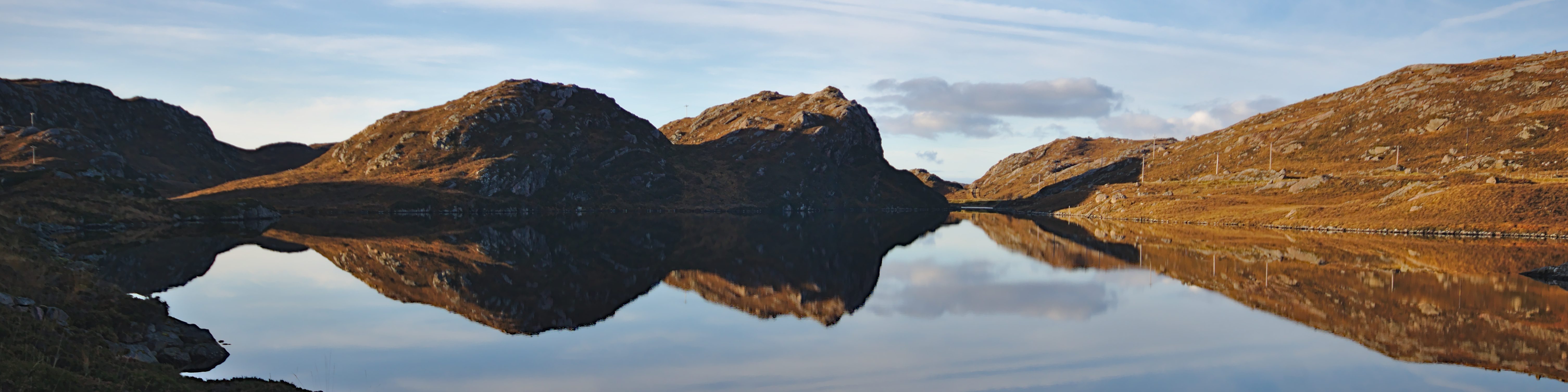


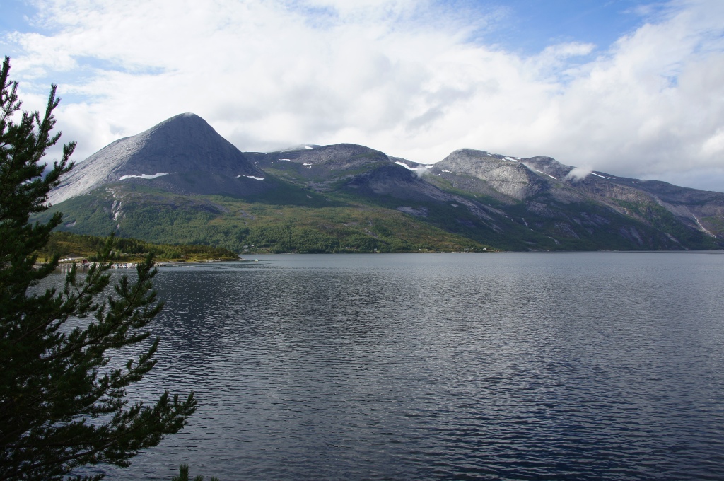


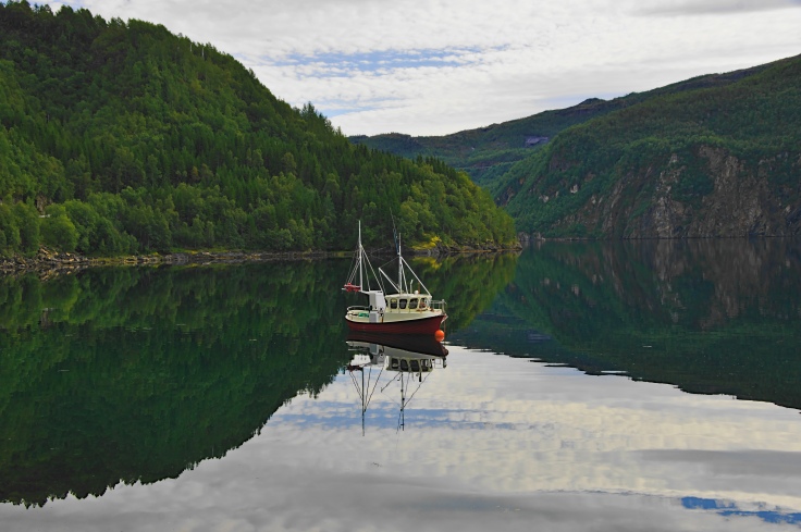


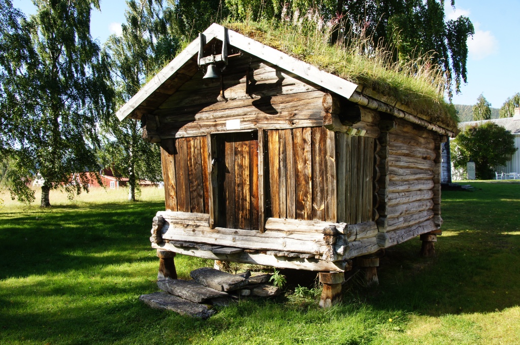


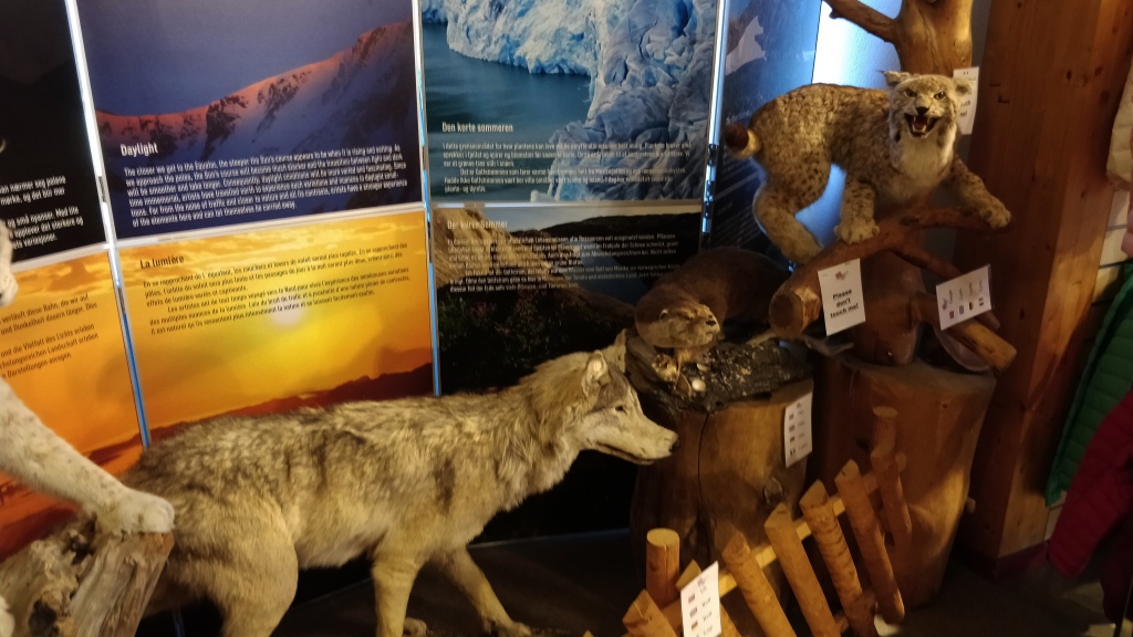


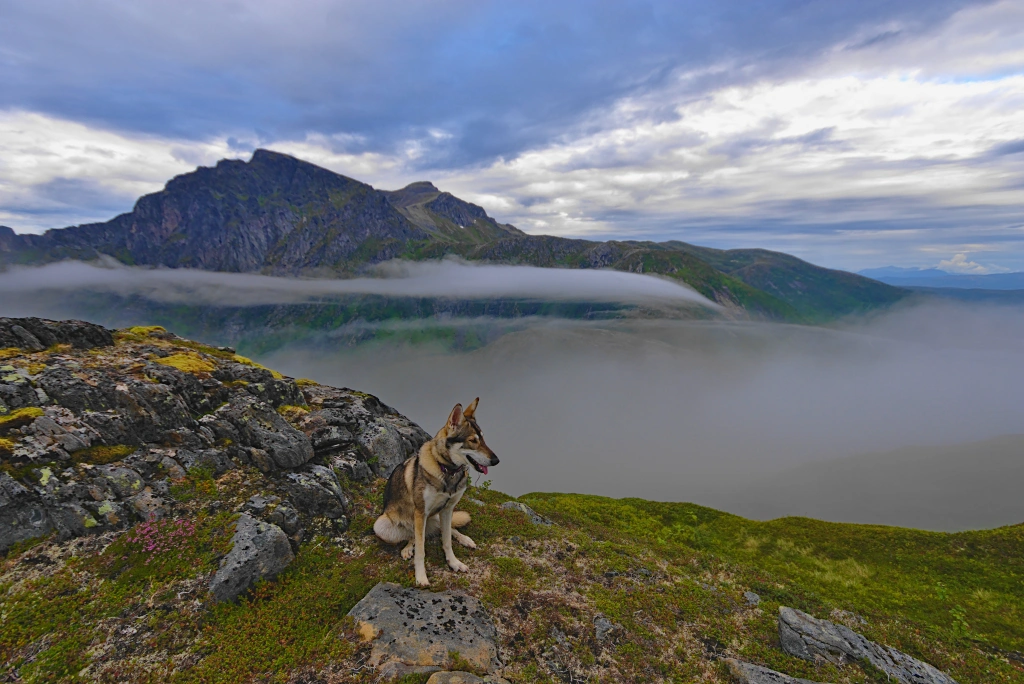


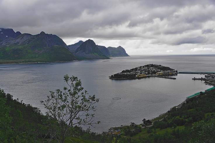


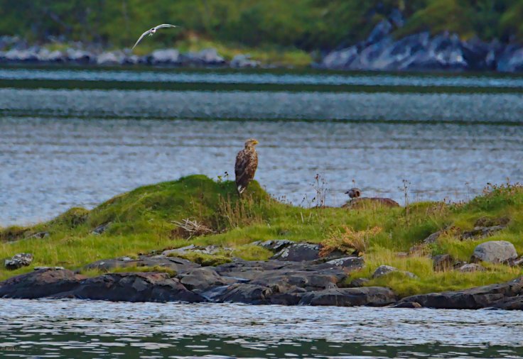


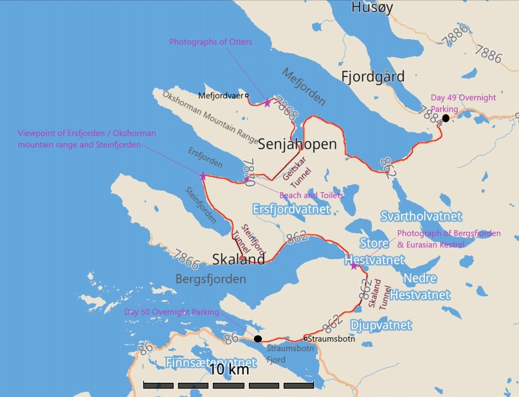


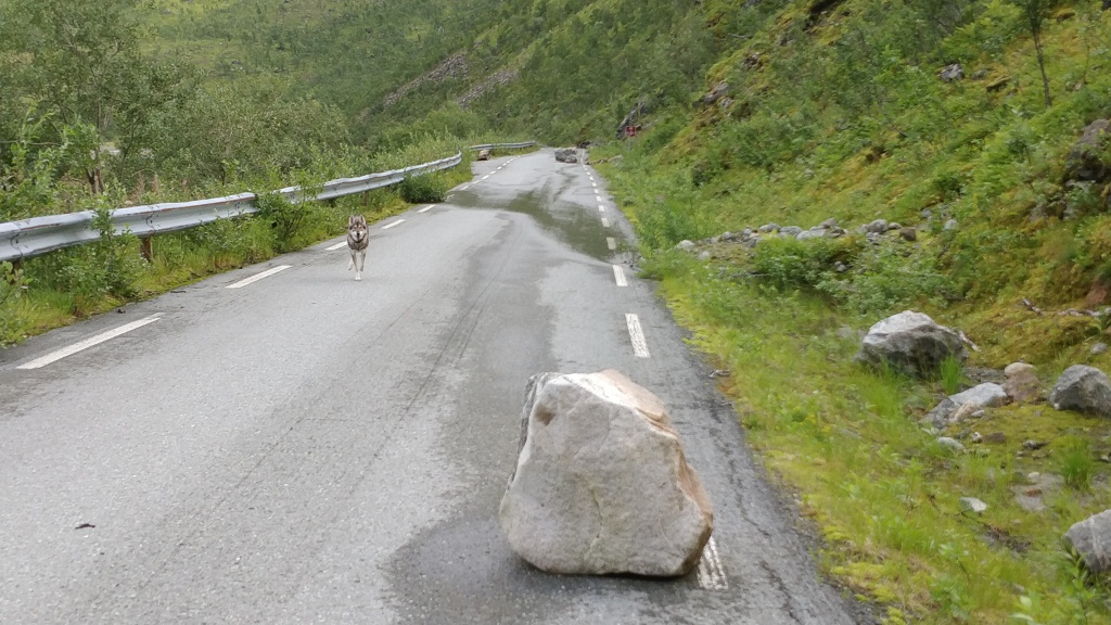

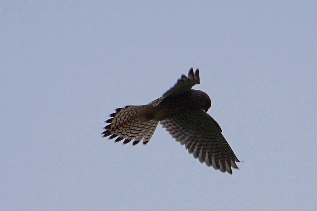


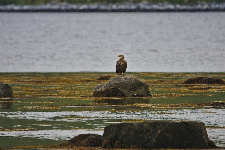


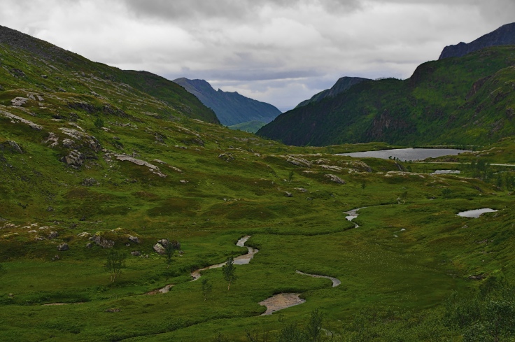


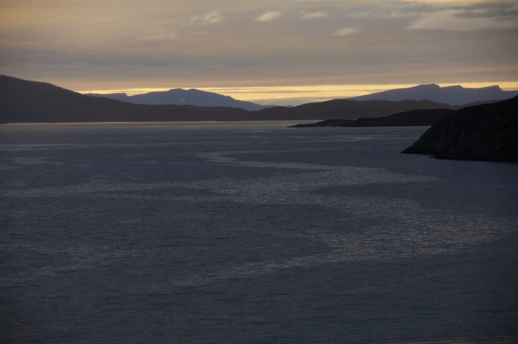

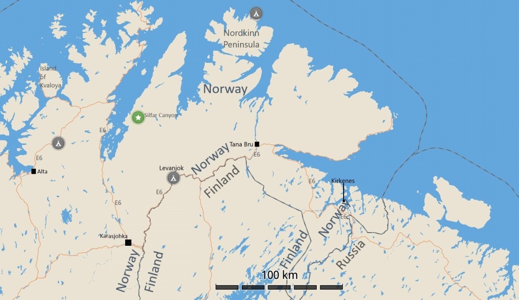

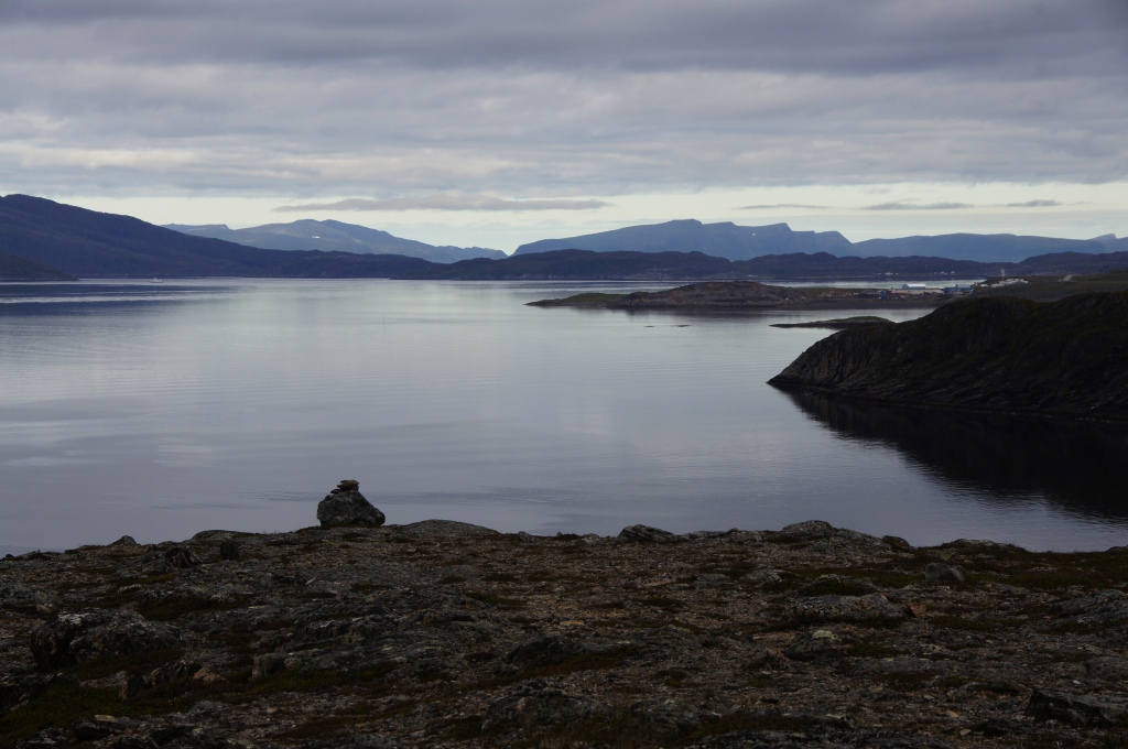


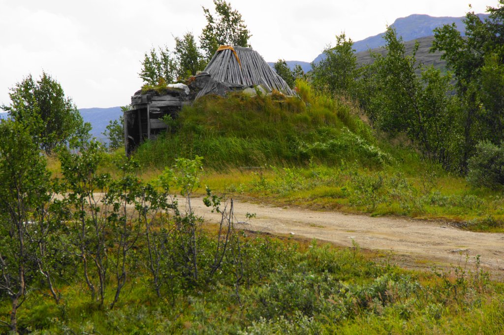


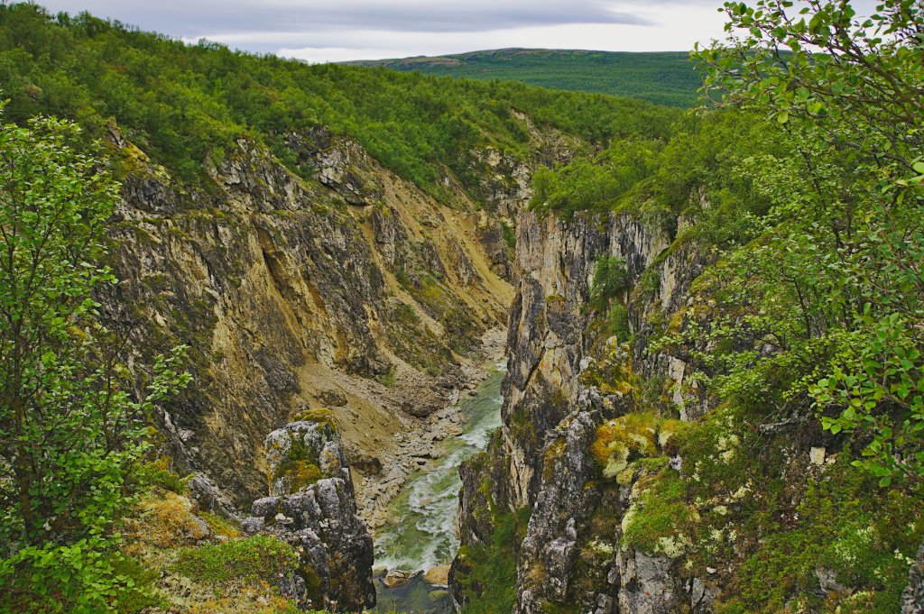


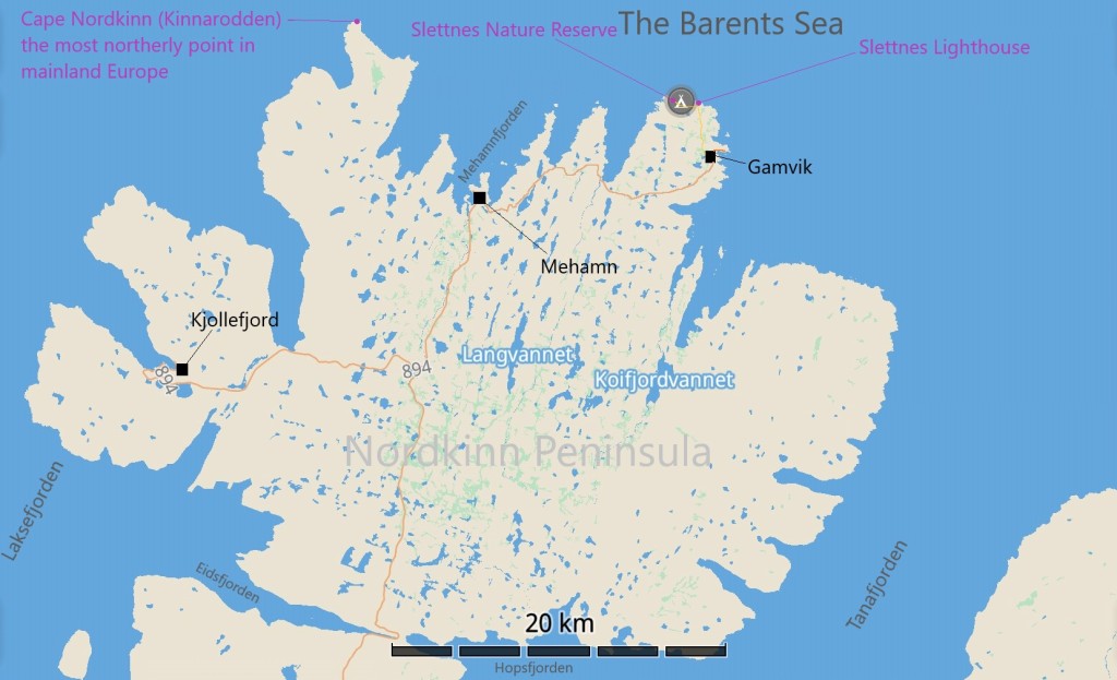


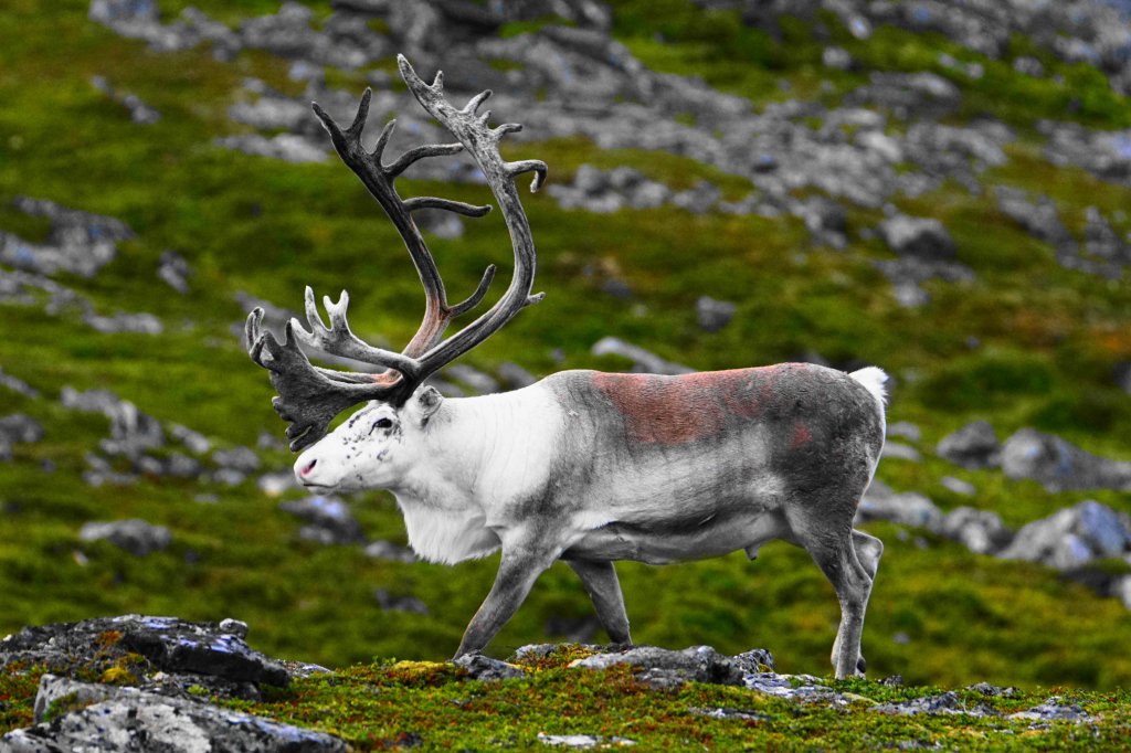


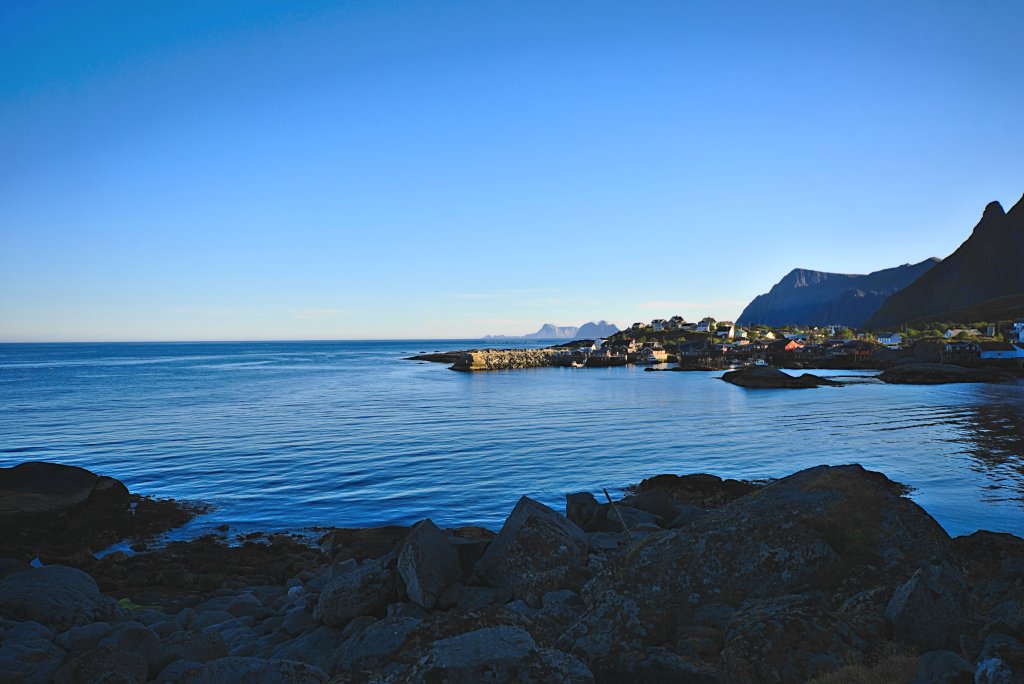


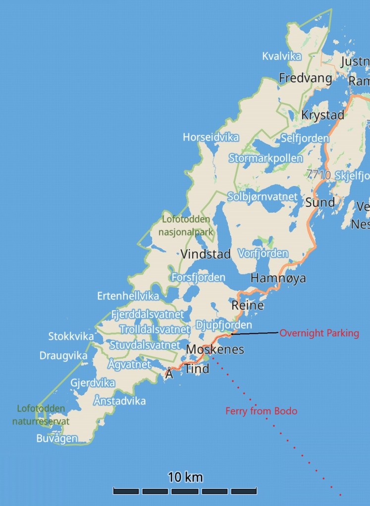


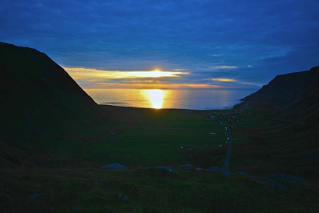
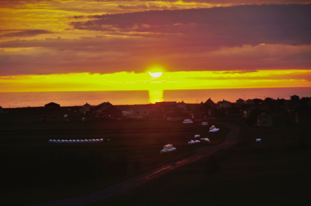


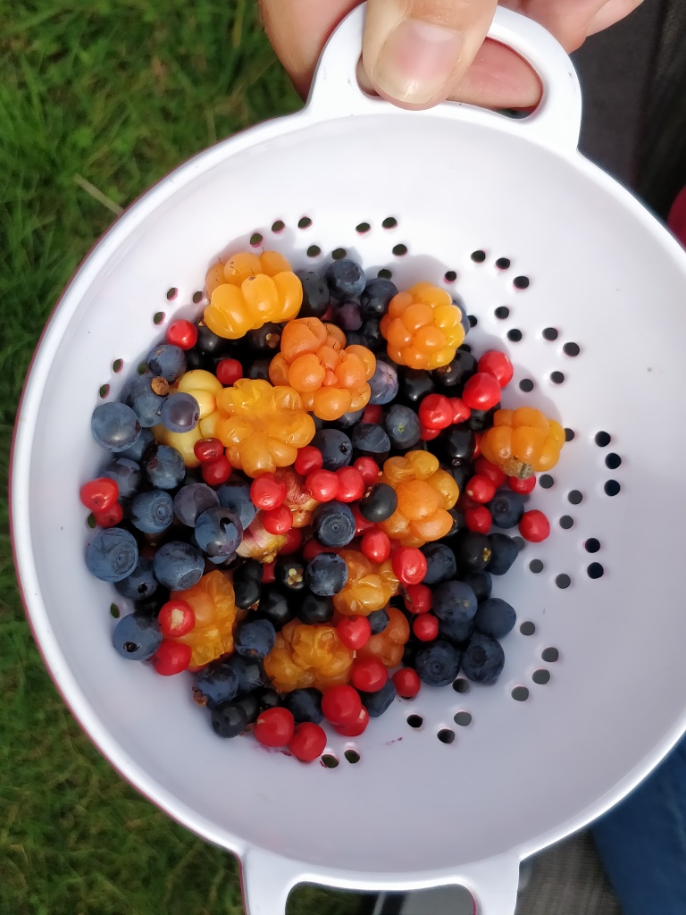


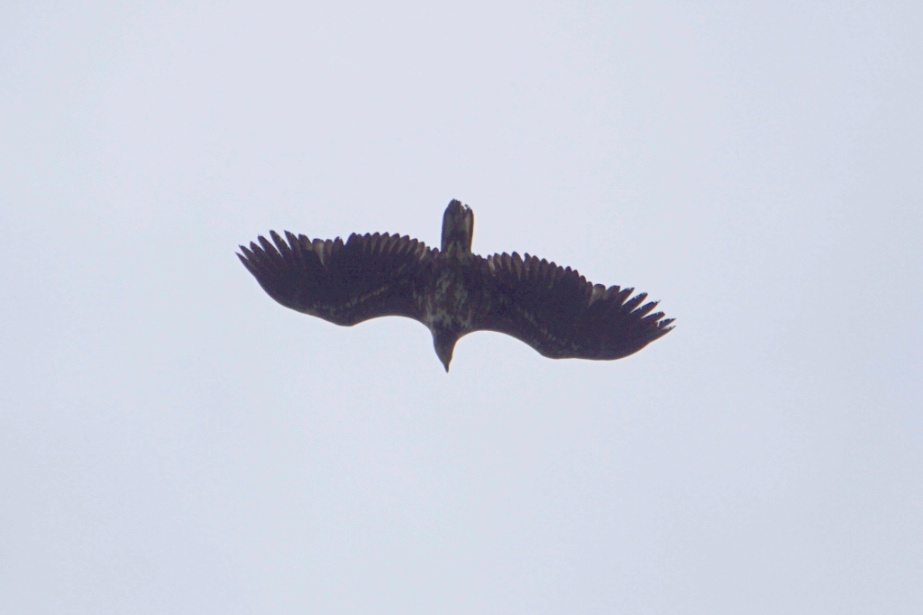


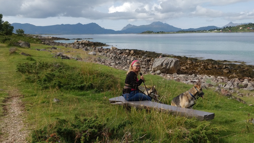


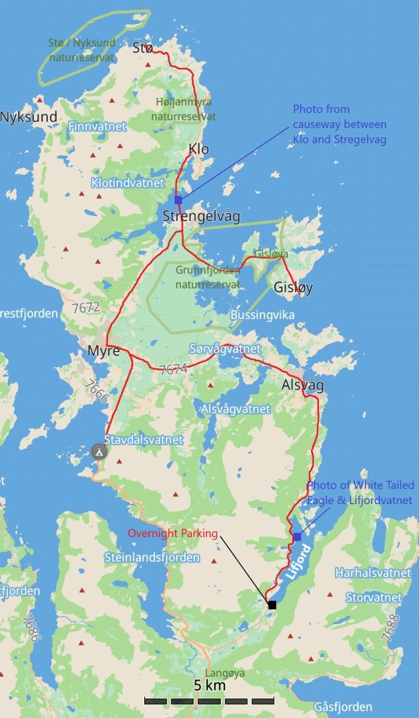


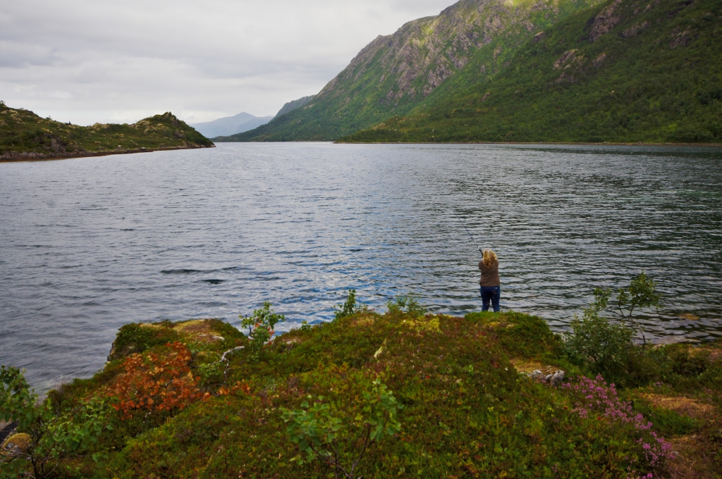


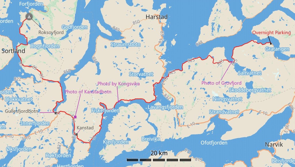


, Norway")